USGS Open-File Report 03-474, G1-03-GM, Gas Hydrates Cruise Report, R/V Gyre, 1-14 May, 2003, Northern Gulf of Mexico
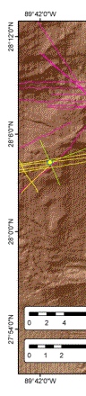
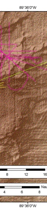
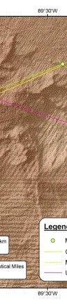
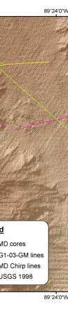
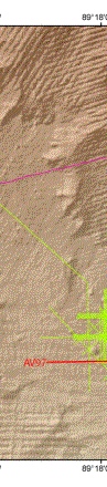
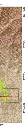
Figure 8. Detailed map of the Atwater Valley region showing USGS track lines collected during G1-03-GM. Data from highlighted line AV97 are shown in Figure 9. The black box outlines lease block AV14.
 |
 |
 |
 |
 |
 |
