A SPATIAL DATABASE OF BEDDING ATTITUDES
to accompany
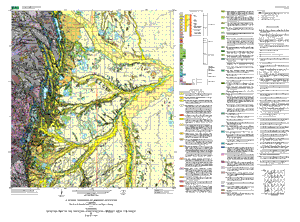
Geologic Map of Boulder-Fort Collins-Greeley Area, Colorado
Version 1.1
Text PDF file (96 KB)
(This version of the report is accessible as defined in Section 508.)
GZIPPED TAR archive of ArcInfo files,
metadata, etc. (2.6
MB)
Zipped archive of ArcInfo files, metadata,
etc. (2.6 MB)
View the download directory which contains the geospatial database. Please refer to the README file for more information.
I-855-G: Geologic Map of the Boulder-Fort Collins-Greeley area, Colorado
| AccessibilityFOIAPrivacyPolicies and Notices | |
| |
|