
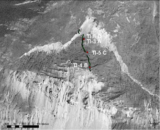
Figure 13 B)-- Enlarged aerial photographic view of upper part of Tidal
Inlet landslide showing GPS profile points (green dots) starting from top of
main scarp
and proceeding
to location of secondary failures. Labels for red dots show GPS monitoring points.
Points TI-6D and TI-3A are so close to each other that they are shown as a single
red point. Linear shadows across portions of width of photo show rotational blocks,
some of which disrupted by secondary failure in middle of view. Link to Figure
13 A.