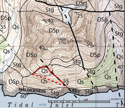
Figure 4.-- Geologic map of northern portion of Tidal Inlet (modified from Brew,
written commun., 2002). Boundary of Tidal Inlet landslide outlined in red. Geologic
units shown are Qs (Surficial Deposits) Kmn (Migmatite in Geikie and Muir Provinces),
DSrt (Undivided Rendu and Tidal Formation Rocks), DSp (Pyramid Peak Limestone),
and Stg (Tidal Formation).
Map contains a contour interval of 100-ft.