Database and Map of Quaternary Faults and Folds in Perú and its Offshore Region |
By José Macharé, Clark H. Fenton, Michael N. Machette, Alain Lavenu, Carlos Costa, and Richard L. Dart |
| U.S. Geological Survey Open-File Report 03-451 |
|
| Version 1.1 |
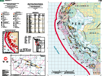
| As part of the International Lithosphere Program’s “World Map of Major Active Faults,” the U.S. Geological Survey (USGS) is assisting in the compilation of a series of digital maps of Quaternary faults and folds in Western Hemisphere countries. The maps show the locations, ages, and activity rates of major earthquake-related features such as faults and fault-related folds. They are accompanied by databases that describe these features and document current information on their activity in the Quaternary. |
| The text of this report is presented here in Portable Document Format. The latest version of Adobe Acrobat Reader or similar software is required to view it. If you wish to download the latest version of Acrobat Reader free of charge, click here . |
| Map PDF file (1.27 MB) |
For viewing and printing. |
| (This version of the report is accessible as defined in Section 508.) | |
| Pamphlet PDF file (732 KB) | (This version of the report is accessible as defined in Section 508.) |
| (This version of the report is accessible as defined in Section 508.) |
| AccessibilityFOIAPrivacyPolicies and Notices | |
| |
|