
Coastal Vulnerability Assessment of Cape Hatteras National Seashore to Sea-Level Rise, USGS Open-File Report 2004-1064
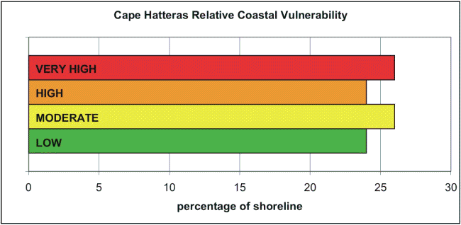
Figure 14. Shows a histogram of the percentage of CAHA shoreline in each vulnerability category. Over 115 km (70 miles) of shoreline is evaluated along the Cape Hatteras National Seashore. Of this total, 26 percent of the mapped shoreline is classified as being at very high vulnerability due to future sea-level rise. Another 24 percent is classified as high vulnerability, 26 percent as moderate vulnerability, and 24 percent as low vulnerability. | ||
 |
||
