Skip past header information USGS Logo with link to USGS web page
Coastal Vulnerability Assessment of Cape Hatteras National Seashore to Sea-Level Rise, USGS Open-File Report 2004-1064


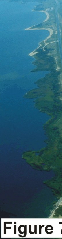
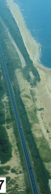
Figure 7. Road relocation between Avon and Buxton. The former location of the road is denoted by the break in vegetation. The barrier is so narrow that there is no room left to move the road landward (very high vulnerability).


Figure 7.   Road relocation between Avon and Buxton. Figure 7.   Road relocation between Avon and Buxton. Figure 7.   Road relocation between Avon and Buxton.

Skip Footer Information

U.S. Department of the Interior, U.S. Geological Survey
URL: http://pubs.usgs.gov/of/2004/1064/html/fig7.html
Maintained by Publishing Services
Last modified: 09:00:57 Thu 20 May 2004
Privacy statement | General disclaimer | Accessibility