Link to USGS home page Link to USGS home page
Coastal and Marine Geology Program
Coastal & Marine Geology Program > Open File Report 2004-1089

The National Assessment of Shoreline Change: A GIS Compilation of Vector Shorelines and Associated Shoreline Change Data for the U.S. Gulf of Mexico

USGS Open File Report 2004-1089

by: Tara L. Miller, Robert A. Morton, Asbury H. Sallenger, Laura J. Moore

Contents:
Introduction
GIS Data Layers
References
Acknowledgments
Contacts
Disclaimer

Introduction

IMSThe data presented in this report have been integrated into the USGS U.S. Gulf of Mexico Shoreline Change Internet Map Server.
Note: In order to use the Map Server, javascript is required to be enabled in your web browser.

The Coastal and Marine Geology Program
of the U.S. Geological Survey has generated a comprehensive database of digital vector shorelines and shoreline change rates for the U.S. Gulf of Mexico. These data, which are presented herein, were compiled as part of the U.S. Geological Survey's National Assessment of Shoreline Change Project. Beach erosion is a chronic problem along most open-ocean shores of the United States. As coastal populations continue to grow and community infrastructures are threatened by erosion, there is increased demand for accurate information including rates and trends of shoreline migration. There is also a critical need for shoreline change data that is consistent from one coastal region to another. One purpose of this work is to develop standard repeatable methods for mapping and analyzing shoreline movement so that periodic updates regarding coastal erosion and land loss can be made nationally that are systematic and internally consistent.

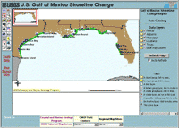
This data compilation for open-ocean, sandy shorelines of the Gulf of Mexico is the first in a series that will eventually include the Atlantic Coast, Pacific Coast, and parts of Hawaii and Alaska. Short- and long-term shoreline change evaluations are based on merging three historical shorelines with a modern shoreline derived from lidar (light detection and ranging) topographic surveys. Historical shorelines generally represent the following time periods: 1800s, 1920s-1930s, and 1970s. The most recent shoreline is derived from data collected over the period of 1998-2002. Long-term rates of change are calculated by linear regression using all four shorelines. Short-term rates of change are simple end-point rate calculations using the two most recent shorelines. Please refer to our full report on shoreline change in the Gulf of Mexico, National Assessment of Shoreline Change: Part 1, Historical Shoreline Changes and Associated Coastal Land Loss Along the U.S. Gulf of Mexico (USGS Open File Report 2004-1043) for additional information regarding methods and results.

Data in this report are organized into data layers by state and are provided as single-point vector datasets with metadata. Vector shorelines may represent a compilation of data from one or more sources and these sources are attributed in the dataset. All data are intended to be GIS-ready inasmuch as the data should not require any additional cleanup, formatting, or renaming of fields in order to use the data in a Geographic Information System (GIS). This project employs the Environmental Systems Research Institute's (ESRI) ArcView as its GIS mapping tool and contains several data layers (or themes) that are used to create a geographic view of the margin off the U.S. Gulf of Mexico. These vector data form a basemap comprised of polygon and line themes that include a U.S. coastline (1:80,000), U.S. cities, and state boundaries.


Related Research Projects:

National Assessment of Coastal Change Hazards
USGS Coastal & Marine Geology Program

Coastal Classification Mapping Project
USGS Coastal & Marine Geology Program

Related Links:

National Assessment of Shoreline Change: Part 1, Historical Shoreline Changes and Associated Coastal Land Loss Along the U.S. Gulf of Mexico - USGS Open File Report 2004-1043
USGS Coastal & Marine Geology Program

Coastal and Marine Geology Internet Map Server
USGS Coastal & Marine Geology Program

Coastal and Marine Geology Program Internet Map Server Introduction and Help
USGS Coastal & Marine Geology Program

ESRI
GIS and mapping software company

Winzip
Winzip Computing, Inc.


Coastal & Marine Geology Program > Open File Report 2004-1089


[an error occurred while processing this directive]