
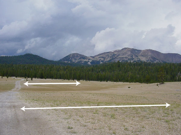
Figure 2 - Photograph looking southwest towards Mammoth Mountain and
perpendicular to a possible fracture system located in the center of
the study area. White arrows indicate strike of the fractures
(northwest). On the left side of the picture is a typical jeep
trail on which the survey was conducted. Mammoth Mountain
represents the southwest corner of the caldera's topographic boundary.
| AccessibilityFOIAPrivacyPolicies and Notices | |
| |
|