Summary
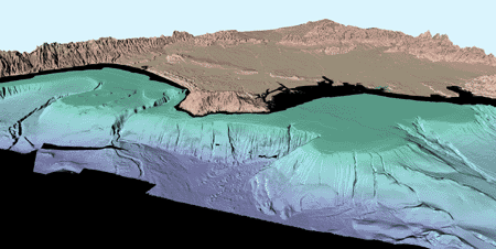
The U.S. Geological Survey in cooperation with the University of New Hampshire and the University of New Brunswick mapped the nearshore regions off Los Angeles and San Diego, California using multibeam echosounders. Multibeam bathymetry and co-registered, corrected acoustic backscatter were collected in water depths ranging from about 3 to 900 m offshore Los Angeles and in water depths ranging from about 17 to 1230 m offshore San Diego. Continuous, 16-m spatial resolution, GIS ready format data of the entire Los Angeles Margin and San Diego Margin are available online as separate USGS Open-File Reports.
For ongoing research, the USGS has processed sub-regions within these datasets at finer resolutions. The resolution of each sub-region was determined by the density of soundings within the region. This Open-File Report contains the finer resolution multibeam bathymetry and acoustic backscatter data that the USGS, Western Region, Coastal and Marine Geology Team has processed into GIS ready formats as of April 2004. The data are available in ArcInfo GRID and XYZ formats. See the Los Angeles or San Diego maps for the sub-region locations.
These datasets in their present form were not originally intended for publication. The bathymetry and backscatter have data-collection and processing artifacts. These data are being made public to fulfill a Freedom of Information Act request. Care must be taken not to confuse artifacts with real seafloor morphology and acoustic backscatter.
TOP OF PAGE
FGDC Metadata
|
![[Link to USGS home page]](images/wrcmgbnr.gif)