Skip past header information
USGS Logo with Link to USGS Home Page
Coastal and Marine Geology Program   /   USGS Woods Hole Science Center

U.S. Geological Survey Open-File Report 2004-1256

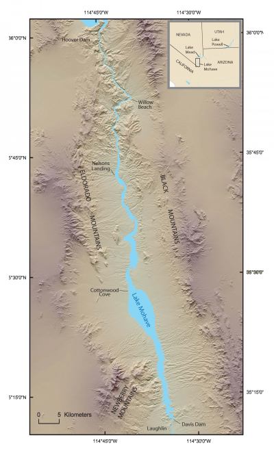
Surficial Geology and Analysis of Post-Impoundment Sediment of Lake Mohave; Interpretation of Sidescan Sonar and Seismic-Reflection Data

By David S. Foster1, Mark K. Capone2, Kenneth F. Parolski3, David C. Twichell1, and Mark J. Rudin4

1U.S. Geological Survey, Woods Hole, Massachusetts
2University of Guam, Mangilao, Guam
3KFP Services, Mashpee, Massachusetts
4Department Health Physics, University of Nevada, Las Vegas, Nevada

2004

Table of Contents

Skip past contents information

Introduction


Methods


Results


Discussion


Conclusion


Acknowledgments


References


Disclaimers


Shaded relief index map showing the location of Lake Mohave between Hoover and Davis Dams and surrounding mountain ranges.

Figure 1. Shaded relief index map showing the location of Lake Mohave between Hoover and Davis Dams and surrounding mountain ranges. Inset shows location of study area in southern Nevada and northwestern Arizona.


Skip Footer Information [an error occurred while processing this directive]