
![]()
New England States Aeromagnetic and Gravity Maps and Data:
A Web Site for Distribution of Data
By David L. Daniels and Stephen L. Snyder
Open-File Report 2004-1258
Online only
Published 2004
![]()
Composite aeromagnetic anomaly map of the New England States and the Gulf of Maine at a simulated flight altitude of 1000 feet above ground (East illumination). Click on map to view larger image (1.2MB).
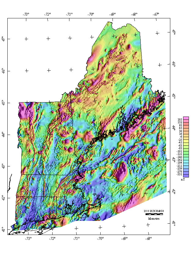
Grids for this map in several formats are available by using the "Get Data..." button.

Click here to see Magnetic maps of individual New England states
USGS Links - || USGS - Eastern Minerals Team || USGS - Geology Discipline || USGS - Home Page ||