In order to study the distribution of water in the unsaturated zone and
potential for ground-water recharge near the Amargosa Desert Research Site
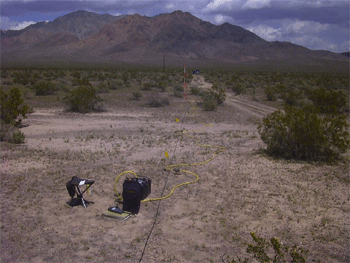
south of Beatty, Nevada, the U.S. Geological Survey collected direct-current
resistivity measurements along three profiles in May 2003 using an eight-channel
resistivity imaging system. Resistivity data were collected along profiles
across the ADRS, across a poorly incised (distributary) channel system
of the Amargosa River southwest of the ADRS, and across a well-incised
flood plain of the Amargosa River northwest of the ADRS.
This report describes results of an initial investigation to estimate
the distribution of water in the unsaturated zone and to evaluate the shallow
subsurface stratigraphy near the ADRS. The geophysical method of dc resistivity
was employed by using automated data collection with numerous electrodes. "Cross
sections" of
resistivity, produced by using an inversion algorithm on the field data,
at the three field sites are presented and interpreted. |