
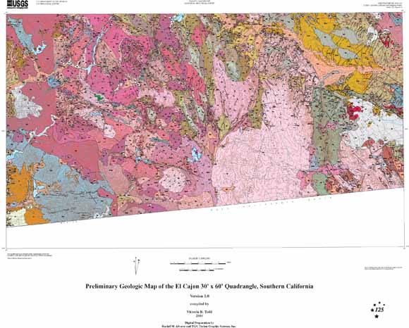
The El Cajon quadrangle is one of about 20 1:100,000-scale topographic quadrangles in southwestern California being mapped and compiled by geologists of the U.S. Geological Survey and California Geological Survey as part of the Southern California Areal Mapping Project (SCAMP) and STATEMAP. Sources used for compilation of the El Cajon quadrangle include unpublished mapping at 1:24,000 scale, and unpublished reconnaissance mapping. This report consists of a geologic map, a brief regional synthesis, and descriptions of map units. Geologic interpretations were aided by U-Pb ages for plutonic and volcanic rocks determined by D.L. Kimbrough, G.H. Girty, and C.T. Herzig at San Diego State University. Plutonic rock names were assigned based upon modal analyses and the International Union of Geological Sciences rock classification (Streckeisen, 1973). |
| File
Name |
File
Type and Description |
File
Size |
| | ||
| DATA FILES |
||
| compressed file of the digital database for this map | 7.2-MB file that opens into a 29.4-MB folder |
|
| FILES FOR VIEWING AND PLOTTING |
||
| A zipped Encapsulated Postscript file for viewing and plotting the geologic map at full scale. The plot is approximately 40 x 32 inches in size | 10.2-MB file that opens into a 34.6 MB file |
|
| A Portable Document Format (PDF) file for viewing and plotting the geologic map at full scale. The plot is approximately 40 x 32 inches in size. | 9 MB |
|
| A zipped Encapsulated Postscript file for viewing and plotting the correlation of map units and abbreviated description of map units, approximately 26 x 28 inches in size. | 772-KB file that opens into a 7.5-MB file |
|
| A Portable Document Format (PDF) file for viewing and plotting the correlation of map units and abbreviated description of map units, approximately 26 x 28 inches in size. | 284 KB |
|
| A Portable Document Format (PDF) file for viewing and printing a pamphlet that accompanies the map. The pamphlet contains a geologic interpretation and the description of map units. | 672 KB |
|
| README |
||
| text version of readme that explains how to use the digital database | 12 KB |
|
| METADATA |
||
| Federal Geographic Data Committee (FGDC) compliant metadata file derived from the digital database. | 40 KB |
|
| SYMBOLS |
||
| which includes:
|
184-KB file that opens into a 1.2-MB folder |
|
For questions about the content of this report, contact Rachel Alvarez
| Help
| PDF help
| Publications main page | Open-File
Reports for 2004 |