Back to Main Page Figure 3. Map of radon activities in and around Waquoit Bay, Cape Cod, Massachusetts, generated during a one-day survey (dpm/L = decays per minute per liter of water). The red bar lengths are scaled proportionally to the radon activities measured as the vessel traveled into the study area, from Vineyard Sound to the north end of Eel Pond (the "incoming" transect), and the green bars denote activities measured as the boat traveled back along approximately the same path (the "outgoing" transect). Elevated radon activities at any location are an indication of significant ground-water discharge. 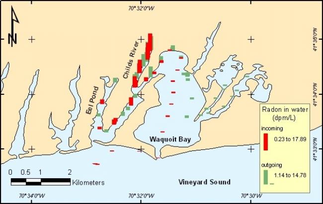
|

 Privacy Statement