 |
|
|
||||
| Central Region Publications |
Landslides mapped using LIDAR imagery, Seattle, Washington |
By William H. Schulz |
Open-File Report 2004–1396 |
 |
| Version 1.0 |
| Published 2004 |
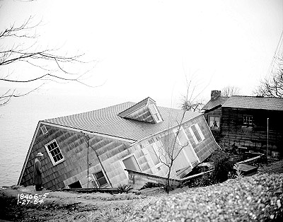
| Landslides pose a significant hazard in Seattle, Washington, where historical records of destructive landslide events date back to the late 1800s. Seattle landslides generally occur on hillslopes along Puget Sound and Lake Washington coastlines, hillslopes along drainages, and on steep, glacially formed ridges. Shallow flows, slides, falls, and topples, and deep-seated slides of earth and debris are common types of Seattle landslides. Inventories compiled of historical Seattle landslides highlight areas prone to landslide activity, but many of the inventories include only landslides that were reported to various government agencies, so they exclude unreported and prehistoric landslides. Geologic, coastal, and landslide-specific maps of the Seattle area also have been created. These maps primarily were constructed using aerial photographs and ground-based study, which is problematic in an area such as Seattle where dense vegetation substantially obscures hillslope morphology. Airborne LIDAR (light detection and ranging) surveys have recently been completed of the Seattle area and provide a clearer representation of the ground surface than is possible with aerial photographs because LIDAR penetrates vegetation. |
| The text of this report is presented here in Portable Document Format. The latest version of Adobe Acrobat Reader or similar software is required to view it. If you wish to download the latest version of Acrobat Reader free of charge, click here . |
It is best to download a large PDF file to your hard drive rather than open
it inside your browser. (A standard click may automatically open the PDF file
inside the browser but doing so will result in a very slow load.)
For guidance on how to do this, go to [http://cpg.cr.usgs.gov/toolbox/download_advice.html].
Downloading the PDF file may take several moments but will be worth the wait. Once it is downloaded, open the PDF from your hard drive using Adobe Acrobat—it will open in a fraction of the time it would take to open the PDF over the Internet.
| For viewing and printing. (This version of the report is accessible as defined in Section 508.) |
LIDAR-based map of Seattle landslides. |
| Text-only version of the Map PDF file. (This version of the map is accessible as defined in Section 508.) |
| AccessibilityFOIAPrivacyPolicies and Notices | |
| |
|