
Coastal and Marine Geology Program / USGS Woods Hole Science Center / Caribbean Project
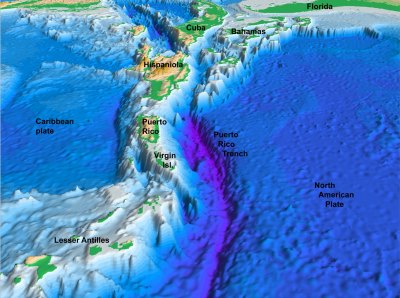
Project PROBE Leg II - Final Report and Archive of Swath Bathymetric Sonar, CTD/XBT and GPS Navigation Data Collected During USGS Cruise 03008 (NOAA Cruise RB0303) Puerto Rico Trench 18 February - 7 March, 2003
USGS Open-File Report 2004-1400
2005
|
Introduction Cruise Data GIS Data Catalog 3D visualization Acknowledgments Contacts Disclaimer Readme |
by Uri ten Brink¹, William Danforth¹, Christopher F. Polloni1, Castle Eugene Parker², Toshihiko Uozumi² and Glynn F. Williams¹
¹ U.S. Geological Survey, Woods Hole Science Center, Woods Hole,
MA 02543 |
Any use of trade names is for descriptive purposes only and does not imply endorsement by the U.S. Government.