|
||||
| U.S. Geological Survey Open-File Report 2004-1435 |

Early to Middle Jurassic Salt in Baltimore Canyon Trough
Published 2005
Version 1.0
By B. Ann McKinney ¹,², Myung W. Lee³, Warren F. Agena³, and C. Wylie Poag²
¹Formerly B. Ann Swift
²U.S. Geological Survey, Woods Hole, Massachusetts 02543
³U.S. Geological Survey, Denver, Colorado 80225
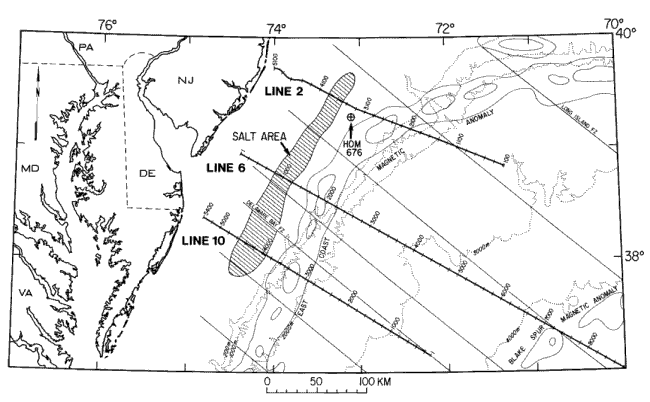 |
Figure 1. The Baltimore Canyon Trough area that lies offshore Maryland, Delaware, and New Jersey between the Carolina Trough to the south and Georges Bank Basin to the northeast. |
Contents
Abstract
Introduction
Geologic Setting
Data Collection
Data Processing
Geophysical Analysis
Discussion
Conclusion
Bibliography
List of Figures
List of Tables
Disclaimers
The research presented in this report was completed in 1992.
Any use of trade names is for descriptive purposes only and does not imply endorsement by the U.S. Government.

| Accessibility | FOIA | Privacy | Policies and Notices | |
 |
|