
|
|
|
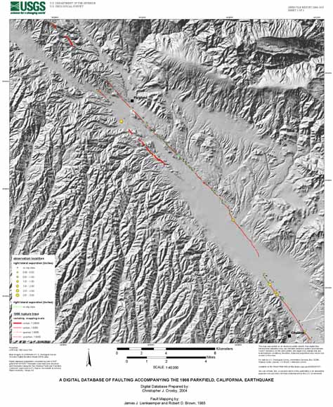
This digital map database is prepared from a previously published map by Lienkaemper and Brown (1985). The fault database delineates tectonic ground rupture associated with the 1966 Parkfield, California earthquake and observation localities along the surface rupture where geologic data were gathered. Our goal is to provide earthquake scientists working along the San Andreas fault near Parkfield with a digital version of the Lienkaemper and Brown (1985) map that may be used for field work, input to geophysical models, and for comparison with future Parkfield earthquakes. |
View the metadata for this report (OFR_2004-1437_metadata.txt; 8 KB). Users can read about the various components (files) associated with the report before they start downloading.
Download the 1966 rupture trace (DEM base) - sheet 1 (66_rupturemap_DEM.pdf; 16.9 MB)
Download the 1966 rupture trace (DOQQ base) - sheet 2 (66_rupturemap_DOQ.pdf; 48.5 MB)
Download the GIS files, metadata and fault coordinates (OFR_2004-1437_files.zip; 392 KB that opens into a 720-KB folder)
For questions about the content of this report, contact Chris Crosby
| Help
| PDF help
| Publications main page | Open-File
Reports for 2004 |