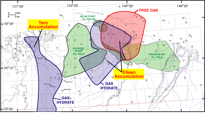
Figure 2. This map depicts the distribution of the Eileen and Tarn gas hydrate accumulations in the area of the Prudhoe Bay, Kuparuk River, and Milne Point oil fields on the North Slope of Alaska.
[Back]
U.S. Department of the Interior | U.S. Geological Survey URL: <http://pubsdata.usgs.gov/pubs/of/2004/1454/fig2.html> Contact: Energy Program Inquiries Questions or Assistance: GS Pubs Web Contact Page Last Modified: Sat Jan 12 23:52 EDT 2013