|
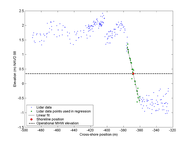
Figure 1. Lidar beach profile from September 15, 1997 at Assateague Island, Virginia. A linear regression is fit through data points on the foreshore, and the horizontal position of the shoreline at the operational MHW elevation is calculated.
|
| [an error occurred while processing this directive] [an error occurred while processing this directive] | ||
|