
Open-File Report 2005-1048
U.S. Geological Survey Open-File Report 2005-1048
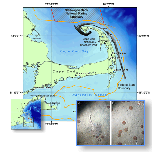
Geological Interpretation of Bathymetric and Backscatter Imagery
of the Sea Floor Off Eastern Cape Cod, Massachusetts
By: L.J. Poppe1, V.F. Paskevich1, B. Butman1, S.D. Ackerman2, W.W. Danforth1, D.S. Foster1, and D.S. Blackwood1
|
|
|||||||||||||
|
June 2006 |
1 - U.S. Geological Survey Coastal and Marine Geology Program 384 Woods Hole Road Woods Hole, MA 02543-1598 |
2 - Massachusetts Coastal Zone Management 384 Woods Hole Road Woods Hole, MA 02543-1598 |

![]() U.S. Department of the Interior |
U.S. Geological Survey
U.S. Department of the Interior |
U.S. Geological Survey
URL: http://pubsdata.usgs.gov/pubs/of/2005/1048/index.htm
Page Contact Information: GS Pubs Web Contact
Page Last Modified: Tuesday, 05-Nov-2024 14:51:05 EST

