
Coastal Vulnerability Assessment of Channel Islands National Park to Sea-Level Rise, USGS Open-File Report 2005-1057
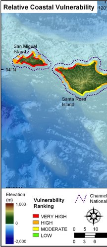
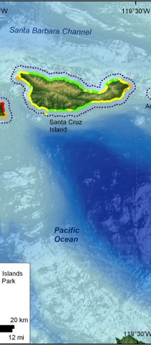
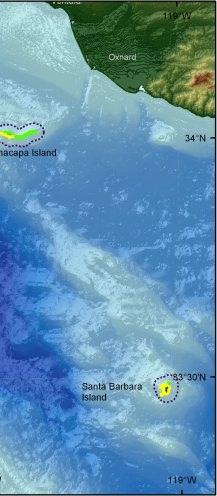
Figure 14. Relative Coastal Vulnerability for Channel Islands National Park. The colored shoreline represents the relative coastal vulnerability index (CVI) determined from the six variables. The very high vulnerability shoreline is located along sandy stretches of coast where regional coastal slope vulnerability is high and significant wave heights are highest. The low vulnerability shoreline is located along rock cliffs where coastal slope is steep and wave heights are low. | ||
 |
 |
 |
