
Coastal Vulnerability Assessment of Golden Gate National Recreation Area to Sea-Level Rise
USGS Open-File Report 2005-1058
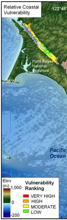
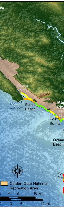
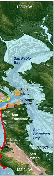
Figure 11. Relative Coastal Vulnerability for GGNRA. The colored shoreline represents the relative coastal vulnerability index (CVI) determined from the six variables. The very high vulnerability shoreline is generally located along sandy beaches where significant wave heights are highest and regional coastal slope is shallow. The lower vulnerability shoreline is located along rock cliffs mostly along the northern part of GGNRA where wave heights are lower and coastal slope is steep. | ||
 |
 |
 |
