 |
|
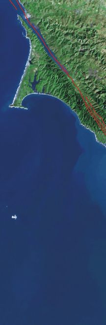
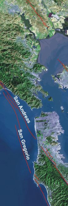
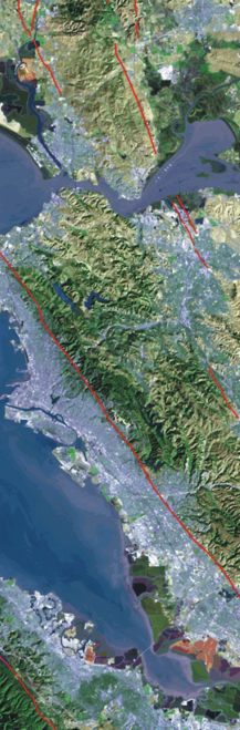
Figure 2. Landsat TM satellite imagery of the San Francisco Bay Area showing major faults including the San Andreas and San Gregorio Faults (this figure courtesy of cooperative research and development between Pacific Gas & Electric Company and the U.S. Geological Survey). http://www.sfbayquakes.org/mapview.html |
||
 |
 |
 |
