 |
|
|
||||
| Open-File Report 2005–1218: Online Version |
| About USGS / Science Topics / Maps, Products & Publications / Education / FAQ |
This report is preliminary and has not been reviewed for conformity with the U.S. Geological Survey editorial standards or with the North American Stratigraphic Code.
Any use of trade names is for descriptive purposes only and does not imply endorsement by the U.S. Government.
Open-File Report 2005-1218
2005
U.S. DEPARTMENT OF THE INTERIOR
U.S. GEOLOGICAL SURVEY
Table of Contents |
Introduction: This report presents a compilation of data on the erosive response, debris-flow initiation processes, basin morphology, burn severity, event-triggering rainfall, rock type, and soils for 608 basins recently burned by 53 fires located throughout the Western United States. (Figure 1). The data presented here are a combination of those collected during our own field research and those reported in the literature. In some cases, data from a Geographic Information System (GIS) and Digital Elevation Models (DEMs) were used to supplement the data from the primary source. Due to gaps in the information available, not all parameters are characterized for all basins.
This database provides a resource for researchers and land managers interested in examining relations between the runoff response of recently burned basins and their morphology, burn severity, soils and rock type, and triggering rainfall. The purpose of this compilation is to provide a single resource for future studies addressing problems associated with wildfire-related erosion. For example, data in this compilation have been used to develop a model for debris flow probability from recently burned basins using logistic multiple regression analysis (Cannon and others, 2004). This database provides a convenient starting point for other studies. For additional information on estimated post-fire runoff peak discharges and debris-flow volumes, see Gartner and others (2004).
Erosive Response: The erosive response of each burned basin in the database has been characterized as a debris flow, flood, or having no response. This information is provided in the literature and also from our field observations. We based our classifications of the erosive response on characteristics of debris flows and floods described by Pierson and Costa (1987). In many cases, no significant erosive response was reported or observed.
Initiation Process: Debris flows following wildfire have been observed to initiate from the failure of discrete landslides on hillslopes (for example, Meyer and others, 2001; Schaub, 2001), through the progressive bulking of runoff with sediment eroded from hillslopes and channels (Meyer and Wells, 1997; Cannon and others, 2001) or by a combination of these two processes (Scott, 1971; Cannon, 2001; Cannon and others, 2001). The debris-flow initiation process for each basin that produced debris flows was characterized by direct field observations or inferred from written reports.
Basin Morphology: Basin morphology is characterized by measures of basin area (square kilometers), average gradient (percent), basin area with slopes greater or equal (GE) to 30 percent (square kilometers), basin area with slopes greater or equal to 50 percent (square kilometers), average basin aspect (degrees), ruggedness, and relief ratio. For each basin, these measures were extracted from a 10- or 30-meter DEM, depending on availability. We delineated basins using the watershed tool in Arcview 8.0. Ruggedness is measured as the maximum change in elevation within a basin divided by the square root of the basin area and is dimensionless (Melton, 1965). Relief ratio is another dimensionless parameter measured as the change in elevation of the longest stream channel (extended to the drainage divide) divided by the length of that channel (Meyer and Wells, 1997).
Burn Severity: Burn severity for each basin was characterized using maps of burn severity generated by either the Burned Area Emergency Rehabilitation (BAER) Team using a number of different techniques, or from the Normalized Burn Ratio (NBR), as determined from Landsat Thematic Mapper data (Key and Benson, 2000). The maps of burn severity generated by the BAER Teams reflect the effects of the fire on soil conditions and the potential hydrologic response and are an amalgam representation of the condition of the residual ground cover, soil erodability, and degree of fire-induced water repellency. The NBR compares changes in vegetation cover before and after the fire. Burn severity maps were obtained from a number of different unpublished sources.
We used the raster calculator in Arcview 8.0 to generate grids defining the area burned at low, moderate, and high severities, and the spatial analyst, zonal statistics tool in Arcview 8.0 to determine the burn severity parameters for each of the basins. These parameters include the area burned at low severity, area burned at moderate severity, area burned at high severity, area burned at moderate and high severity and total area burned (square kilometers).
Event Triggering Rainfall: Tipping-bucket rain gages installed and monitored by the United States Geological Survey (USGS) and Remote Access Weather Stations (RAWS) installed by the Bureau of Land Management (BLM) and monitored by the Forest Service provided the rainfall data for some of the burned areas. Rainfall data were also provided by the cited references but were unavailable for some areas. Tipping-bucket rain gages record the time of each 0.254-mm accumulation of rainfall. The RAWS record rainfall totals at 5-minute intervals. Using these data, we calculated the storm total (millimeters), duration (hours:minutes), average intensity (millimeters per hour) and peak intensities (millimeters per hour) at durations of 10, 15, 30 and 60 minutes for the first storm that produced either a debris flow or sediment-laden flood response from the burned area. The rainfall recorded by the gage located nearest to a basin was used to represent that basin’s rainfall conditions. If two or more rain gages were an equal distance from a basin, then the gage that recorded heavier rainfall was used. For those basins that showed no response, we used rainfall measurements from the storm with the highest totals and intensities to impact the area in the first two years following the fire.
Rock Type and Soils: Field observations of rock type and geological maps of the burned areas were used to characterize the primary rock type underlying each basin, and soil samples were taken from several locations throughout each of the burned basins. The grain-size distributions of the samples are determined by using sieve and hydrometer testing (Bowles, 1970). Measures of the median (D50), mean ([D16+D84]/2), sorting ([D84-D16]/2) and skewness ([mean-median]/sorting) were determined from the grain-size distribution using the methods of Inman (Inman, 1952). These measures are represented in phi (Φ) units which are logarithmic transformations of particle diameter (d) in millimeters where, Φ = -log2d (Krumbein, 1934).
The State Soil Geographic (STATSGO) database (Schwartz and Alexander, 1995) was used to define additional soil parameters for the basins. These include available water capacity (inches per inch), clay content (percentage of material less than 2 mm in size), k factor (the water erosion component of the universal soil loss equation), organic matter (percent by weight), permeability (inches/hour), soil thickness (inches), hydrologic group (1-4: 1 = high infiltration, 2 = moderate infiltration, 3 = slow infiltration, 4 = very slow infiltration), soil slope (percent), liquid limit (percent moisture by weight), and hydric capacity (0-1, 1 = all points hydric).
Results: Each point in Figure 1 represents the location of a fire and provides a link to the database containing
information about individual drainage basins within the fire.
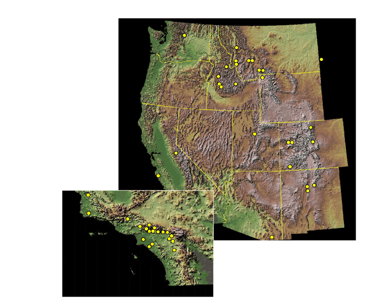
Figure 1. Fires located in the western United States.
The data also can be viewed by using the following index of fires by state and clicking on the fire name. You can view the database or download it in excel (.xls) format.
|
References:
| AccessibilityFOIAPrivacyPolicies and Notices | |
| |
|