Introduction
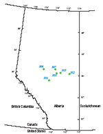
The purpose of this report is to provide the sources of data that were used to prepare one-dimensional (1-D) burial history reconstructions at 6 well locations in the central Alberta part of the Western Canada Sedimentary Basin (WCSB); the 1-D reconstructions were then used to calibrate a three-dimensional (3-D) model of petroleum systems in the basin. The 3-D model was generated in order to calculate the relative influences through time of geologic processes that control generation, migration, and accumulation of petroleum. The software used for both 1-D and 3-D modeling was PetroMod1D (version 8.0) of Integrated Exploration Systems GmbH (IES), Germany. The well locations were chosen because they have measured downhole temperature data, either from the modeled well or from a nearby well, and they have measured vitrinite reflectance data from the coal-bearing Mannville Group to aid in calibrating burial history models.
|

