|
|
|
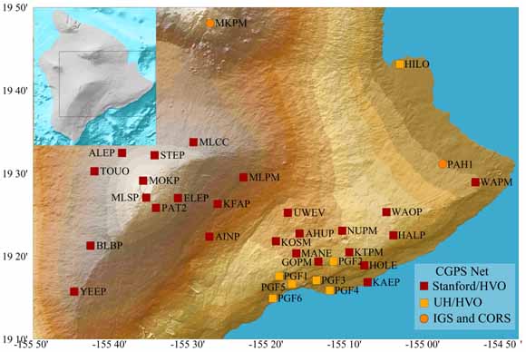
This report summarizes GPS data and observations collected between 1997 and 2004 on the island of Hawai‘i with static surveying and continuously recording instruments. On Kīlauea, the long-term deformation field is dominated by steady southeastern velocities of more than 6 cm/year and uplift of about 2 cm/yr at stations on the south flank (with respect to a fixed Pacific Plate). Superimposed on this steady signal are transient displacements associated with magmatic intrusions, earthquakes, and aseismic slip events. The largest of these was the January 30, 1997 dike intrusion and eruption. GPS instruments near Kīlauea’s summit also record numerous additional short-term fluctuations associated with variations in magma reservoir pressure and geometry. From mid-1997 through 2001, the dominant signal at the summit was deflationary, with maximum subsidence of ~5 cm/yr south of Kīlauea caldera. However, inflation of the magma system was observed from late 2001 to May 2002, and from mid-2003 through 2004. The east rift zone eruption continued at the Pu‘u ‘O‘o vent during the entire period of this report. Mauna Loa Volcano, which most recently erupted in 1984, showed low rates of contraction across the summit caldera and southeasterly motion of the southeast flank from 1997 until May 2002. Reinflation started abruptly in May 2002. Inflation contin ued through 2004, but at highly variable rates. Extension rates on a baseline across the summit caldera slowed in October 2002 and increased again starting in mid-2003. The most dramatic change during the inflation period, however, was a significant increase in extension rate on longer baselines, from the northwest to southeast flanks, in July 2004. GPS measurements on Hualalai volcano show no significant motion relative to the Pacific Plate.
|
Download this report as a 48-page PDF document (of2005-1425.pdf; 13.1 MB)
For questions about the content of this report, contact Asta Miklius
| Help
| PDF help
| Publications main page | Open-File
Reports for 2005 |