Paskevich, Valerie, 2006, STATE_BOUNDS: internal United States boundaries: Open-File Report 2006-1046, U.S. Geological Survey, Coastal and Marine Geology Program, Woods Hole Science Center, Woods Hole, MA.This is part of the following larger work.Online Links:
- <http://pubs.usgs.gov/of/2006/1046/data/basemaps/state_bounds/state_bounds.zip>
- <http://pubs.usgs.gov/of/2006/1046/htmldocs/data_catalog.htm>
- <http://pubs.usgs.gov/of/2006/1046/data/basemaps/state_bounds/>
Arsenault, M.A., Reid, J.A., Jenkins, C.J., Williams, S.J., Poppe, L.J., and Reid, J.M., 2006, Surficial Sediment Character of the New York-New Jersey Offshore Continental Shelf Region: a GIS Compilation: Open-File Report 2006-1046, U.S. Geological Survey, Coastal and Marine Geology Program, Woods Hole Science Center, Woods Hole, MA.Online Links:
This is a Vector data set. It contains the following vector data types (SDTS terminology):
Horizontal positions are specified in geographic coordinates, that is, latitude and longitude. Latitudes are given to the nearest 0.000001. Longitudes are given to the nearest 0.000001. Latitude and longitude values are specified in Decimal degrees.
The horizontal datum used is North American Datum of 1983.
The ellipsoid used is Geodetic Reference System 80.
The semi-major axis of the ellipsoid used is 6378137.000000.
The flattening of the ellipsoid used is 1/298.257222.
Sequential unique whole numbers that are automatically generated.
Coordinates defining the features.
(508) 548-8700 x2281 (voice)
(508) 457-2310 (FAX)
vpaskevich@usgs.gov
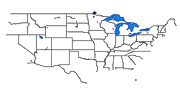
This data layer includes the internal boundaries for the United States and the political boundaries of the US, Canada and Mexico. The state boundaries are drawn to the U.S. coastline and does not include any coastline or islands. This data layer may be used with the high resolution NOS80K coastline (allus80k.shp) which does not include any internal boundaries.
Paskevich, Valerie, Unpublished Material, USA: United States basemap data layer.
Person who carried out this activity:
(508) 548-8700 x2281 (voice)
(508) 457-2310 (FAX)
vpaskevich@usgs.gov
Data sources produced in this process:
This data set contains the internal boundaries for the continental US and the US/Canada and US/Mexico political boundaries.
No additional checks for topological consistency were performed on this data set.
Are there legal restrictions on access or use of the data?
- Access_Constraints: None
- Use_Constraints:
- These data are not to be used for legal purposes.
Public domain data are freely redistributable with proper metadata and source attribution. Please recognize the U.S. Geological Survey (USGS) as the source of this information.
(508) 548-8700 x2281 (voice)
(508) 457-2310 (FAX)
vpaskevich@usgs.gov
Downloadable Data
Although all data have been used by the USGS, no warranty, expressed or implied, is made by the USGS as to the accuracy of the data and/or related materials. The act of distribution shall not constitute any such warranty, and no responsibility is assumed by the USGS in the use of these data or related materials.Any use of trade, product, or firm names is for descriptive purposes only and does not imply endorsement by the U.S. government.
| Data format: | The SHP file contains the geospatial data. The SHX file contains the index of the geospatial data. The DBF file contains the attribute data in dBASE format. The PRJ file contains the coordinate system information (optional). The AVL file contains the legend information (optional). The SBN and SBX files contain the spatial index of the geospatial data (optional). The XML file contains the metadata describing the data set <data set name>.shp.xml. An ASCII version of the metadata file. A browse graphic showing the data layer coverage and extent (optional). in format SHP (version 3.3) ESRI Polygon Shapefile Size: 2.623 |
|---|---|
| Network links: |
<http://pubs.usgs.gov/of/2005/1048/data/basemaps/boundaries/state_bounds/state_bounds.zip> <http://pubs.usgs.gov/of/2005/1048/htmldocs/data_catalog.htm> <http://pubs.usgs.gov/of/2005/1048/data/basemaps/boundaries/state_bounds/> |
| Media you can order: |
DVD-ROM
(Density 4.75
Gbytes)
(format UDF)
|
These data are available in Environmental Systems Research Institute (ESRI) shapefile format. The user must have ArcGIS® or ArcView® 3.0 or greater software to read and process the data file. In lieu of ArcView or ArcGIS, the user may utilize another GIS application package capable of importing data. A free data viewer, ArcExplorer, capable of displaying the data is available from ESRI at www.esri.com.
(508) 548-8700 x2281 (voice)
(508) 457-2310 (FAX)
vpaskevich@usgs.gov