USGS-NPS-NASA EAARL Topography
|
|
John C. Brock, C. Wayne Wright, Matt Patterson, Amar Nayegandhi, and Judd Patterson Click
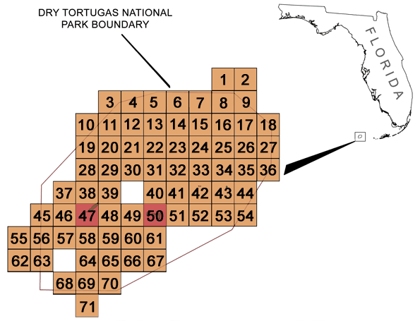
on a tile number (1-71) in the map below to view the To expedite download times and to prevent any possible errors, right click on the desired PDF map tile and save the file to disk. If you require all of the map tiles or would like a copy of the Open-File Report in DVD format, please contact: Emily Klipp in the USGS, FISC St. Petersburg office: eklipp@usgs.gov.
USGS Open File Report 2006-XXXX |

![]() U.S. Department of the Interior | U.S.
Geological Survey
U.S. Department of the Interior | U.S.
Geological Survey
URL: http://pubsdata.usgs.gov/pubs/of/2006/1244/HTML/home.htm
Page Contact Information: Feedback
Page Last Modified:
22:37:36 Sat 12 Jan 2013