Open-File Report 2006-1254
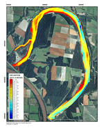 
Hydroacoustic tools were used to map depth, elevation, and substrate on DeSoto Lake in March 2006. DeSoto Lake, located on the DeSoto National Wildlife Refuge in Iowa and Nebraska, is one of the largest oxbow lakes of the Missouri River system. It is used by over 500,000 migratory birds each fall and spring and is also an important aquatic resource for anglers. Management concerns at the lake include the effects of erosion and sedimentation, aquatic vegetation establishment, shorebird habitat availability at different lake levels, and fish habitat structure. DeSoto Lake was cut off from the Missouri River in 1960, and the current mapping updates previous lower-resolution bathymetric maps created from lake surveys in 1967 and 1979. The new maps provide managers tools to assess aquatic habitats and provide a baseline for future monitoring of lake sedimentation and erosion. |
Version 1.0 Posted October 2006
|
Part or all of this report is presented in Portable Document Format (PDF); the latest version of Adobe Acrobat Reader or similar software is required to view it. Download the latest version of Acrobat Reader, free of charge or go to access.adobe.com for free tools that allow visually impaired users to read PDF files.
