Western Earth Surface Processes
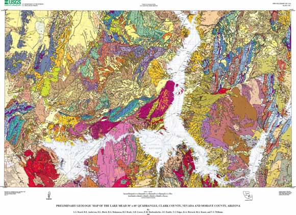
The geologic map of the Lake Mead 30’ x 60’ quadrangle was completed for the U.S. Geological Survey's Las Vegas Urban Corridor Project and the National Parks Project, National Cooperative Geologic Mapping Program. Lake Mead, which occupies the northern part of the Lake Mead National Recreation Area (LAME), mostly lies within the Lake Mead quadrangle and provides recreation for about nine million visitors annually. The lake was formed by damming of the Colorado River by Hoover Dam in 1939. The recreation area and surrounding Bureau of Land Management lands face increasing public pressure from rapid urban growth in the Las Vegas area to the west. This report provides baseline earth science information that can be used in future studies of hazards, groundwater resources, mineral and aggregate resources, and of soils and vegetation distribution.
The preliminary report presents a geologic map and GIS database of the Lake Mead quadrangle and a description and correlation of map units. The final report will include cross-sections and interpretive text. The geology was compiled from many sources, both published and unpublished, including significant new mapping that was conducted specifically for this compilation. Geochronologic data from published sources, as well as preliminary unpublished 40Ar/39Ar ages that were obtained for this report, have been used to refine the ages of formal Tertiary stratigraphic units and define new informal Tertiary sedimentary and volcanic units.
Plate 1, geologic map as a 37" x 27" PDF file (of2007-1010_plate1_map.pdf; 64.5 MB).
Plate 2, correlation of map units as a ~37" x 30" PDF file (of2007-1010_plate2_cmu.pdf; 448 kB).
Plate 3, list of map units as a ~34" x 30" PDF file (of2007-1010_plate3_lmu.pdf; 464 kB).
Pamphlet as a 109-page PDF file (of2007-1010_pamphlet.pdf; 9.7 MB).
ReadMe.txt as an ASCII text file (lm100k_readme.txt; 8 kB).
Metadata as an ASCII text file (lm100k_metadata.txt; 40 kB).
Geodatabase This is a zipped compressed file (lm100k_geodatabase.zip; 48.2 MB compressed, 97.4 MB when opened).
Geodatabase This is a zipped compressed file (lm100k_shapefiles.zip; 45.5 MB compressed, 86.6 MB when opened).
For questions about the content of this report, contact Sue Beard
Download the Suggested citation and version history
Download a current version of Adobe Reader for free
| Help
| PDF help
| Publications main page | Western Open-File Reports for 2007 |
| Geology | Western Earth Surface Processes
|
This report is available only on the Web

![]() U.S. Department of the Interior | U.S. Geological Survey
U.S. Department of the Interior | U.S. Geological Survey
URL: https://pubs.usgs.gov/of/2007/1010/
Page Contact Information: Michael Diggles
Page Last Modified: September 24, 2009