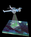
USGS-NPS-NASA EAARL Topography
|
|
Located within this Web site is a folder named LIDAR. Each subfolder within the LIDAR folder contains an edited Lidar DEM GeoTIFF, hillshade grid, contour shapefile, and tile extent shapefile for a specific map tile. The sub-folders are named according to the UTM coordinates of their upper-left corner (in thousands of meters). Each GIS layer has an accompanying XML file that holds the metadata. There is also a folder named Shapefiles that contains the vector data that was used while creating the PDF maps. These layers include the coastline of Maryland, the boundary of George Washington Birthplace National Monument, and the Lidar tile centroids. All files are consistent with the UTM Zone 18 N Coordinate System, NAD83 Datum, and GRS80 Spheroid. From the list below, select a tile to see a folder of associated GIS layers for that region.
|

![]() U.S.
Department of the Interior | U.S.
Geological Survey
U.S.
Department of the Interior | U.S.
Geological Survey
URL: https://pubsdata.usgs.gov/pubs/of/2007/1179/HTML/raw_data.html
Page Contact Information: Feedback
Page Last Modified:
20:37:52 Wed 07 Dec 2016