
U.S. Geological Survey
Open-file Report 2007-XXXX
Seafloor Mapping and Benthic Habitat GIS for Southern California, Volume III |
|
 |
|
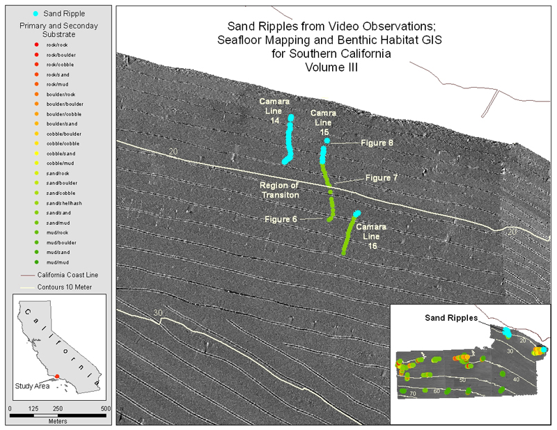
| Figure 5. Map showing location of sand ripples in north-eastern region of study area for cruise S105SC. | |
Accessibility
|
FOIA
| Privacy
|
Policies and Notices
U.S. Department of the Interior
U.S. Geological Survey
URL: https://walrus.wr.usgs.gov/
maintained by Michael Diggles
last modified 12 December 2005 (ng)