

|
|
Western Coastal and Marine Geology Program
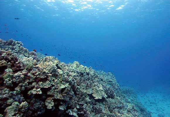
The impending development for the west Hawai‘i coastline adjacent to Kaloko-Honokōhau National Historical Park (KAHO) may potentially alter coastal hydrology and water quality in the marine waters of the park. Water resources are perhaps the most significant natural and cultural resource component in the park, and are critical to the health and well being of six federally listed species. KAHO contains ecosystems of brackish anchialine pools, two 11-acre fishponds, and 596 acres of coral reef habitats, all fed by groundwater originating upslope. The steep gradients on high islands, combined with typically porous substrates and high rainfall levels at upper elevations, make these settings especially vulnerable to shifts in submarine groundwater discharge (SGD) and its entrained nutrients and pollutants. Little is known about the magnitude, rate, frequency, and variability of SGD and its influence on contaminant loading to Hawaiian coastal environments.
Recent studies show that groundwater flux through the park is vital to many ecosystem components including anchialine ponds and wetland biota. The function of these ecosystems may be vulnerable to changes in groundwater flow stemming from natural changes (climate and sea level) and land use (groundwater pumping and contamination). Oki and others (1999) showed that increased groundwater withdrawals for urban development since 1978 likely decreased groundwater flux to the coast by 50%. During this same time, the quality of groundwater has been vulnerable to increases in contaminant and nutrient/fertilizer additions associated with industrial, commercial and residential use upslope from KAHO (Oki and others, 1999).
High-resolution measurements of waves, currents, water levels, temperature and salinity were collected in the marine portion of the park from November, 2005, through July, 2006, to establish baseline information on the magnitude, rate, frequency, and variability of SGD. These data are intended to help researchers and resource managers better understand the hydrodynamics of the oceanographic environment in the park’s coastal waters as it pertains to the pathway of SGD and associated nutrient and contaminant input to the park’s coral reef ecosystem.
Measurements were made of the oceanographic environment (waves, tides, currents, salinity and temperature) using hydrodynamic techniques to characterize and quantify the distribution, input and throughput of freshwater and associated nutrient/contaminant within the near shore environment of KAHO through the emplacement of a series of bottom-mounted instruments deployed in water depths less than 15 m. This study was conducted in support of the National Park Service (NPS) by the U.S. Geological Survey (USGS) Coastal and Marine Geology Program’s Coral Reef Project. These measurements support the ongoing studies of the Coral Reef Project to better understand the transport mechanisms of sediment, larvae, nutrients, pollutants and other particles on Pacific coral reefs. Subsequent reports will address the spatial and temporal variability in groundwater input and the associated nutrient flux in the park’s waters
Download this report as a 43-page PDF file (of2007-1310.pdf; 4.1 MB).
USGS Scientific Investigations Report 2008-5128, Submarine Ground Water Discharge and Fate Along the Coast of Kaloko-Honokōhau National Historical Park, Hawai‘i; Part 2, Spatial and Temporal Variations in Salinity, Radium-Isotope Activity, and Nutrient Concentrations in Coastal Waters, December 2003–April 2006, by Karen Knee, Joseph Street, Eric Grossman, and Adina Paytan (2008)
USGS Scientific Investigations Report 2010-5081, Submarine Ground Water Discharge and Fate Along the Coast of Kaloko-Honokōhau National Historical Park, Hawai‘i; Part 3, Spatial and Temporal Patterns in Nearshore Waters and Coastal Groundwater Plumes, December 2003-April 2006, by Eric E. Grossman, Joshua B. Logan, M. Katherine Presto, and Curt D. Storlazzi (2010)
For questions about the content of this report, contact Kathy Presto
Suggested citation and version history
Download a free copy of the latest version of Adobe Reader.
|
Help |
PDF help |
Publications main page |
| Western Open-File Reports for 2007 |
| Geology | Coastal and Marine Geology
|

![]() U.S. Department of the Interior | U.S. Geological Survey
U.S. Department of the Interior | U.S. Geological Survey
URL: https://pubs.usgs.gov/of/2007/1310/
Page Contact Information: Michael Diggles
Page Created: January 11, 2008
Page Last Modified: June 24, 2010