KLEIN_BS1M.tif - 1 meter Klein 3000 sidescan-sonar backscatter GeoTIFF mosaic of the nearshore portion of the Cape Ann to Salisbury Beach Massachusetts survey area.

Metadata also available as - [Outline] - [Parseable text]

Frequently-anticipated questions:


What does this data set describe?

Title:
KLEIN_BS1M.tif - 1 meter Klein 3000 sidescan-sonar backscatter GeoTIFF mosaic of the nearshore portion of the Cape Ann to Salisbury Beach Massachusetts survey area.
Abstract:
These data were collected under a cooperative agreement with the Massachusetts Office of Coastal Zone Management (CZM) and the U.S. Geological Survey, Coastal and Marine Geology Program, Woods Hole Science Center. Initiated in 2003, the primary objective of this program is to develop regional geologic framework information for the management of coastal and marine resources. Accurate data and maps of sea-floor geology are important first steps toward protecting fish habitat, delineating marine reserves, and assessing environmental changes due to natural or human impacts. The project is focused on the inshore waters (5-30m deep) of Massachusetts between the New Hampshire border and Cape Cod Bay.

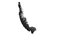
Data collected for the mapping cooperative have been released in a series of USGS Open-File Reports<http://woodshole.er.usgs.gov/project-pages/coastal_mass/html/current_map.html>. This spatial dataset is from the Cape Ann and Salisbury Beach Massachusetts project area. They were collected in two separate surveys in 2004 and 2005 and cover approximately 325 square kilometers of the inner continental shelf. High resolution bathymetry and backscatter intensity were collected in 2004 and 2005. Seismic profile data, sediment samples and bottom photography were also collected in 2005.

  1. How should this data set be cited?

    U.S. Geological Survey, 2008, KLEIN_BS1M.tif - 1 meter Klein 3000 sidescan-sonar backscatter GeoTIFF mosaic of the nearshore portion of the Cape Ann to Salisbury Beach Massachusetts survey area.: Open-File Report 2007-1373, U.S. Geological Survey, Coastal and Marine Geology Program, Woods Hole Science Center, Woods Hole, Massachusetts.

    Online Links:

    This is part of the following larger work.

    Barnhardt, Walter A. , Andrews, Brian D. , Ackerman, Seth D. , Baldwin, Wayne E. , and Hein, Christopher J. , 2008, High-Resolution Geological Mapping of the Inner Continental Shelf: Cape Ann to Salisbury Beach, Massachusetts.: Open-File Report 2007-1373, U.S. Geological Survey, Coastal and Marine Geology Program, Woods Hole Science Center, Woods Hole, Massachusetts.

    Online Links:

  2. What geographic area does the data set cover?

    West_Bounding_Coordinate: -70.808447
    East_Bounding_Coordinate: -70.654992
    North_Bounding_Coordinate: 42.858106
    South_Bounding_Coordinate: 42.664722

  3. What does it look like?

    <https://pubs.usgs.gov/of/2007/1373/GIS/browse_jpg/klein_bs1m.jpg> (JPEG)
    black and white thumbnail image of backscatter mosaic

  4. Does the data set describe conditions during a particular time period?

    Beginning_Date: 08-Sep-2005
    Ending_Date: 16-Sep-2005
    Currentness_Reference: ground condition

  5. What is the general form of this data set?

    Geospatial_Data_Presentation_Form: remote-sensing image

  6. How does the data set represent geographic features?

    1. How are geographic features stored in the data set?

      This is a Raster data set. It contains the following raster data types:

      • Dimensions 21235 x 12126 x 1, type Pixel

    2. What coordinate system is used to represent geographic features?

      The map projection used is Transverse Mercator.

      Projection parameters:
      Scale_Factor_at_Central_Meridian: 0.999600
      Longitude_of_Central_Meridian: -69.000000
      Latitude_of_Projection_Origin: 0.000000
      False_Easting: 500000.000000
      False_Northing: 0.000000

      Planar coordinates are encoded using row and column
      Abscissae (x-coordinates) are specified to the nearest 1.000000
      Ordinates (y-coordinates) are specified to the nearest 1.000000
      Planar coordinates are specified in meters

      The horizontal datum used is D_WGS_1984.
      The ellipsoid used is WGS_1984.
      The semi-major axis of the ellipsoid used is 6378137.000000.
      The flattening of the ellipsoid used is 1/298.257224.

  7. How does the data set describe geographic features?

    klein_bs1m.tif.vat

    Count
    Count of pixels (Source: ESRI)

    VALUE

    COUNT

    Value
    Value of pixel (Source: ESRI)

    Range of values
    Minimum:0
    Maximum:255

    OID
    Internal feature number. (Source: ESRI)

    Entity_and_Attribute_Overview:
    There are no attributes associated with a GeoTIFF image. Image pixel values contain acoustic reflectivity values normalized to an 8-bit data range (0-255). Low-backscatter is represented by dark tones (low values) and high-backscatter is represented by bright tones (high values). The background data value (0) is set to "no data" so the data range is 1-255. Small differences in contrast stretch (DN values exist because of variations in sea and weather conditions on each survey day.


Who produced the data set?

  1. Who are the originators of the data set? (may include formal authors, digital compilers, and editors)

  2. Who also contributed to the data set?

  3. To whom should users address questions about the data?

    Brian Andrews
    U.S. Geological Survey
    Geographer
    384 Woods Hole Rd.
    Woods Hole, MA 02543-1598
    USA

    508-548-8700 x2348 (voice)
    508-457-2310 (FAX)
    bandrews@usgs.gov


Why was the data set created?

The purpose of these data is to measure the relative backscatter reflectance from towed sidescan-sonar in the survey area for regional geologic interpretations from Cape Ann to Salisbury Beach, Massachusetts.


How was the data set created?

  1. From what previous works were the data drawn?

    (source 1 of 1)
    Source_Contribution:
    System Setup and Operation: In the nearshore area, acoustic backscatter data were collected using a Klein 3000 dual frequency sidescan sonar (132/445 kHz). The sonar fish was towed approximately 25 m astern of the R/V Connecticut and approximately 10 m off the bottom. Data were collected along tracklines spaced 100 apart at an average speed of 5 knots. Navigation for all sidescan data used RTK-GPS.

  2. How were the data generated, processed, and modified?

    Date: Sep-2005 (process 1 of 5)
    Backscatter data from the Klein 3000 were collected using SonarPro (ver. 9.0) acquisition software and recorded during the survey in eXtended Triton Format (xtf). The Klein 3000 operates at dual frequencies of 132 & 445 kHz. The lower frequency data were used in this mosaic. The sidescan-sonar was configured to collect data at 100m range on either side of the towfish for a total swath width of 200m. Each line file was processed for beam angle and slant range correction using LINUX based Xsonar/ShowImage (ver 1.0) as described in Danforth (1997).

    The specific parameters used in Xsonar are listed below:

    Demultiplexing Range and Filter Option: Swath Width= 200m Across Track/Along Track Filter= 4 x 3 pings Port and Starboard Normalize=4000 pings Input= 16 bit

    Beam Patter Correction: Number of lines= 150 Ping Overlap=75 Max Beam Angle=90 Response Angle:55

    Person who carried out this activity:

    Brian Andrews
    U.S. Geological Survey
    Geographer
    384 Woods Hole Rd.
    Woods Hole, MA 02543-1598
    USA

    508-548-8700 x2348 (voice)
    508-457-2310 (FAX)
    bandrews@usgs.gov

    Date: Sep-2005 (process 2 of 5)
    Xsonar Mosaic Process: Each survey line was mapped into a raw raster file (*.raw) in Xsonar at a resolution of 1m per pixel so that the odd and even line numbers were in two separate raster files. The 80-byte header for each raw raster file was removed and the images was converted to a raster (.ras) file with the command:

    dd if=filename.ras of=filename.ras bs=80 skip=1

    These resulting rasters (.ras) were converted to a TIFF using Adobe Photoshop (ver. 10).

    Person who carried out this activity:

    Brian Andrews
    U.S. Geological Survey
    Geographer
    384 Woods Hole Rd
    Woods Hole, MA 02543-1598
    USA

    508-548-8700 x2348 (voice)
    508-457-2310 (FAX)
    bandrews@usgs.gov

    Date: Sep-2005 (process 3 of 5)
    PCI Mosaicking: A new PCI project (ver.10.1.3) and an associated pix (05005Master.pix) file was created to mosaic the tiff files together. Each tiff file was imported to the pix file using the OrthoEngine module.

    Person who carried out this activity:

    Brian Andrews
    U.S. Geological Survey
    Geographer
    384 Woods Hole Rd
    Woods Hole, MA 02543-1598
    USA

    508-548-8700 x2348 (voice)
    508-457-2310 (FAX)
    bandrews@usgs.gov

    Date: Sep-2005 (process 4 of 5)
    Ground control points (GCPs) for each line were identified from adjacent overlapping lines. Once GCPs were collected, each line was orthorectified to the master pix file that is referenced to the Universal Transverse Mercator coordinate system (UTM) Zone 19 WGS84. The rectified line was then mosaicked into the master mosaic by digitized cutlines. All GCPs were saved to text files with RMS errors for each point.

    Person who carried out this activity:

    Brian Andrews
    U.S. Geological Survey
    Geographer
    384 Woods Hole Rd
    Woods Hole, MA 02543-1598
    USA

    508-548-8700 x2348 (voice)
    508-457-2310 (FAX)
    bandrews@usgs.gov

    Date: Dec-2007 (process 5 of 5)
    The horizontal position of the final 1m Klein backscatter mosaic was compared to a 2m backscatter mosaic from the SEA SwathPlus bathymetric sonar. Although the dynamic range of the Klein backscatter is better than the SwathPlus backscatter, the positional accuracy of the side-mount SwathPlus data is more accurate than the towed Klein data because the GPS receiver was mounted at the top of the side mount, directly above the SwathPlus sonar head. This reduces error in the x and y position of the data. A total of 10 Ground control points were collected between the SwathPlus and Klein mosaic using PCI OrthoEngine module (ver. 10.1.3). Final root mean square (RMS) error between Klein and SwathPlus mosaics is 9.10m in the x and 12.34m in the Y direction.

    Person who carried out this activity:

    Brian Andrews
    U.S. Geological Survey
    Geographer
    384 Woods Hole Rd.
    Woods Hole, MA 02543-1598
    USA

    508-548-8700 x2348 (voice)
    508-457-2310 (FAX)
    bandrews@usgs.gov

  3. What similar or related data should the user be aware of?

    Barnhardt, Walter A. , Andrews, Brian D. , and Butman, Bradford, 2006, High-Resolution Mapping of the Inner Continental Shelf: Nahant to Gloucester, Massachusetts: Open-File Report 2005-1293, U.S. Geological Survey, Coastal and Marine Geology Program, Woods Hole Science Center, Woods Hole, MA.

    Online Links:

    Ackerman, Seth D. , Butman, Bradford, Barnhardt, Walter A. , Danforth, William W. , and Crocker, James M. , 2006, High-Resolution Geologic Mapping of the Inner Continental Shelf: Boston Harbor and Approaches, Massachusetts: Open-File Report 2006-1008, U.S. Geological Survey, Coastal and Marine Geology Program, Woods Hole Science Center, Woods Hole, MA.

    Online Links:

    Danforth, William W. , 1997, Xsonar/ShowImage: A complete system for rapid sidescan-sonar processing and display.: Open-File Report 97-686, U.S. Geological Survey, Woods Hole Science Center, Woods Hole, MA.

    Paskevich, V.F., 1996, MAPIT: An improved method for mapping digital sidescan sonar data using the Woods Hole Image Processing System (WHIPS) Software: Open-File Report 96-281, U.S. Geological Survey, Woods Hole Science Center, Woods Hole, MA.


How reliable are the data; what problems remain in the data set?

  1. How well have the observations been checked?

  2. How accurate are the geographic locations?

    These data were navigated using Real-Time Kinematic Global Positioning System (RTK-GPS) signal from a RTK base station established by USGS for this survey. RTK-GPS provides horizontal position accuracies (x and y) on the decimeter scale (<http://www.noaa.gov>; <http://www.nos.noaa.gov>; <http://www.ngs.noaa.gov>). The x,y, and z position of the sidescan-sonar towfish was calculated from estimated depth and layback from the GPS receiver on the survey vessel. The accuracy of the actual position of the sidescan-sonar towfish is dependant on this estimated layback. The accuracy of the horizontal position of the towfish is estimated at 10m.

    The positional accuracy of the final georeferenced Klein backscatter mosaic was adjusted by registering the Klein mosaic to the backscatter collected with the SEA SwathPlus bathymetric sonar. The SwathPlus backscatter has better positional accuracy because the GPS antenna was mounted directly over the sonar head to minimize xy offsets between the acquired RTK-GPS position and SwathPlus sonar transducers.

  3. How accurate are the heights or depths?

  4. Where are the gaps in the data? What is missing?

    Although both the 132 kHz and 445 kHz frequency data were collected, only the low frequency (132 kHz) data were processed and included in this mosaic. All lines surveyed were used in the final mosaic.

  5. How consistent are the relationships among the observations, including topology?


How can someone get a copy of the data set?

Are there legal restrictions on access or use of the data?

Access_Constraints: None
Use_Constraints:
The intended scale of these data is 1:25,000. Public domain data from the U.S. Government are freely redistributable with proper metadata and source attribution. Please recognize the U.S. Geological Survey (USGS) as the source of this information.

  1. Who distributes the data set? (Distributor 1 of 1)

    Brian Andrews
    U.S. Geological Survey, Woods Hole Science Center
    Geographer
    384 Woods Hole Rd.
    Woods Hole, MA 02543
    USA

    508-548-8700 x2348 (voice)
    bandrews@usgs.gov

  2. What's the catalog number I need to order this data set?

    Downloadable Data

  3. What legal disclaimers am I supposed to read?

    Neither the U.S. Government, the Department of the Interior, nor the USGS, nor any of their employees, contractors, or subcontractors, make any warranty, express or implied, nor assume any legal liability or responsibility for the accuracy, completeness, or usefulness of any information, apparatus, product, or process disclosed, nor represent that its use would not infringe on privately owned rights. The act of distribution shall not constitute any such warranty, and no responsibility is assumed by the USGS in the use of these data or related materials. Any use of trade, product, or firm names is for descriptive purposes only and does not imply endorsement by the U.S. Government.

  4. How can I download or order the data?

  5. What hardware or software do I need in order to use the data set?

    These data in a tiled GeoTIFF format are distributed as a compressed WinZip file. The user must have software capable of uncompressing a WinZip (ver. 9.0) file and viewing a tiled GeoTIFF image file.


Who wrote the metadata?

Dates:
Last modified: 26-Jan-2009
Metadata author:
Brian Andrews
U.S. Geological Survey
Geographer
384 Woods Hole Rd.
Woods Hole, MA 02543-1598
USA

508-548-8700 x2348 (voice)
508-457-2310 (FAX)
bandrews@usgs.gov

Metadata standard:
FGDC Content Standards for Digital Geospatial Metadata (FGDC-STD-001-1998)
Metadata extensions used:


Generated by mp version 2.8.25 on Mon Jan 26 13:55:11 2009