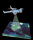
USGS-NPS-NASA EAARL Topography

LIDAR Illustration

Home Link

Purpose Link

PDF Maps Link

Raw Data Link

Link to ArcMap Files

Metadata Link

Collaborators-current page


Collaborators


Funding for this project was provided by the NPS - Geologic Resources


U S Geological Survey Logo and Link

United States Geological Survey

Center for Coastal and Watershed Studies

Florida Integrated Science Center


National Park Service Logo and Link

National Park Service

Inventory & Monitoring Program

Northeast Coastal and Barrier Network


NASA Cooperator Logo and Link

National Aeronautics and Space Administration

Wallops Flight Facility

EAARL: Experimental Advanced Airborne Research Lidar


Accessibility FOIA Privacy Policies and Notices

Take Pride in America logo USA.gov logoU.S. Department of the Interior | U.S. Geological Survey
URL: https://pubsdata.usgs.gov/pubs/of/2007/1375/HTML/collaborators.html
Page Contact Information: Feedback
Page Last Modified: 20:42:14 Wed 07 Dec 2016