U.S. Geological Survey Open-File Report 2008-1154
Preliminary Map of Potentially Karstic Carbonate Rocks in the Central and Southern Appalachian StatesBy D.J. WearyPublished 2008 |
||
Karst is a landscape produced by
dissolution of rocks and the development of integrated subterranean
drainages dominated by the flow of ground water in solutionally
enlarged conduits. Karst landscapes typically include cave entrances,
sinkholes, blind valleys, losing streams, springs, and large and
small-scale solution features on bedrock surfaces. Water-bearing rocks
beneath the surface containing solutionally enlarged pores, fractures,
or conduits are referred to as karst aquifers. About 40 percent of all ground
water extracted in the United States comes from karst aquifers (Karst
Waters Institute). Karst means many things to many people. To most
cavers and many speleologists, karst means areas containing caves. To
engineers, home builders, local governments, and insurance companies,
karst is exemplified by the occurrence of sinkholes and subsidence
hazard. To hydrologists, well drillers, and environmental consultants,
the focus on karst may be more limited to karst aquifers and springs.
Precise figures are not available, but ground collapses in karst areas
in the United States require hundreds of millions of dollars in repair
and mitigation costs each year. Most karst in the United States is
formed in either carbonate or evaporite rocks. This map depicts only
areas of carbonate rock outcrop, the chief host for karst formation in
the eastern United States.
The U.S. Geological Survey (USGS), in cooperation with the National
Cave and Karst Research Institute (NCKRI), the National Speleological
Society (NSS), and various State geological surveys, is working on a new
national karst map that will delineate areas of karst and karst-like
features nationwide. This product attempts to identify potentially
karstic areas of the Appalachian states as defined by the Appalachian
Regional Commission (ARC), with the addition of the state of Delaware.
This map is labeled preliminary because there is an expectation that it
will be revised and updated as part of a new national karst map. Data Available in This ReportPreliminary Map of Potentially Karstic Carbonate Rocks in
the
Central and Southern Appalachian States: complete
OF 2008-1154 map plate (Appalachian_karst.pdf – 35.7-MB
PDF file) GIS data available as both compressed shapefiles and
personal geodatabase files. The shapefiles are smaller (shapefiles.zip – 9.6-MB .zip file).
An ArcMap file (Appalachian_karst.mxd)
is included for display of the personal geodatabase data set (geodatabase.zip
– 367.5-MB .zip file; ArcGIS V. 9.2 and above required). DOWNLOAD Adobe Reader free of charge |
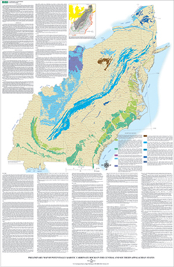 Thumbnail image of “Preliminary Map of Potentially Karstic Carbonate Rocks in the Central and Southern Appalachian States” (detailed graphic files may be downloaded at left). |
|

![]() U.S.
Department of the
Interior | U.S. Geological Survey
U.S.
Department of the
Interior | U.S. Geological Survey
URL: https://pubsdata.usgs.gov/pubs/of/2008/1154/index.html
Page Last Modified:
21:18:41 Wed 07 Dec 2016
Direct questions and comments to:
David J. Weary
U.S. Geological Survey
Email: dweary@usgs.gov
Phone: (703) 648-6897