Open-File Report 2008–1211
Abstract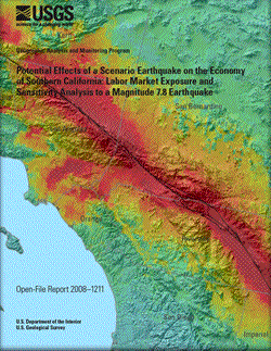
The Multi-Hazards Demonstration Project (MHDP) is a collaboration between the U.S. Geological Survey (USGS) and various partners from the public and private sectors and academia, meant to improve Southern California’s resiliency to natural hazards (Jones and others, 2007). In support of the MHDP objectives, the ShakeOut Scenario was developed. It describes a magnitude 7.8 (M7.8) earthquake along the southernmost 300 kilometers (200 miles) of the San Andreas Fault, identified by geoscientists as a plausible event that will cause moderate to strong shaking over much of the eight-county (Imperial, Kern, Los Angeles, Orange, Riverside, San Bernardino, San Diego, and Ventura) Southern California region. This report contains an exposure and sensitivity analysis of economic Super Sectors in terms of labor and employment statistics. Exposure is measured as the absolute counts of labor market variables anticipated to experience each level of Instrumental Intensity (a proxy measure of damage). Sensitivity is the percentage of the exposure of each Super Sector to each Instrumental Intensity level. The analysis concerns the direct effect of the scenario earthquake on economic sectors and provides a baseline for the indirect and interactive analysis of an input-output model of the regional economy. The analysis is inspired by the Bureau of Labor Statistics (BLS) report that analyzed the labor market losses (exposure) of a M6.9 earthquake on the Hayward fault by overlaying geocoded labor market data on Instrumental Intensity values. The method used here is influenced by the ZIP-code-level data provided by the California Employment Development Department (CA EDD), which requires the assignment of Instrumental Intensities to ZIP codes. The ZIP-code-level labor market data includes the number of business establishments, employees, and quarterly payroll categorized by the North American Industry Classification System. According to the analysis results, nearly 225,000 business establishments, or 44 percent of all establishments, would experience Instrumental Intensities between VII (7) and X (10). This represents more than 4 million employees earning over $45 billion in quarterly payroll. Over 57,000 of these establishments, employing over 1 million employees earning over $10 billion in quarterly payroll, would experience Instrumental Intensities of IX (9) or X (10). Based upon absolute counts and percentages, the Trade, Transportation, and Utilities Super Sector and the Manufacturing Super Sector are estimated to have the greatest exposure and sensitivity respectively. The Information and the Natural Resources and Mining Super Sectors are estimated to be the least impacted. Areas estimated to experience an Instrumental Intensity of X (10) account for approximately 3 percent of the region’s labor market. |
Version 1.0 Posted September 2008 For additional information contact: Part or all of this report is presented in Portable Document Format (PDF); the latest version of Adobe Reader or similar software is required to view it. Download the latest version of Adobe Reader, free of charge. |
Sherrouse, Benson C., Hester, David J., and Wein, Anne M., 2008, Potential effects of a scenario earthquake on the economy of Southern California—Labor market exposure and sensitivity analysis to a magnitude 7.8 earthquake: U.S. Geological Survey Open-File Report 2008–1211, 26 p.
Introduction
Data Sources
Data Suppression
ZIP Code Reconciliation
Methodology
Estimates of Labor Market Exposure and Sensitivity
Discussion
References
Appendix 1. Modified Mercalli Intensity (MMI) Scale Descriptions
Appendix 2. Exposure and Sensitivity Estimates by Minimum, Maximum, Area Weighted, and Dominant Instrumental Intensities

![]() U.S. Department of the Interior | U.S. Geological Survey
U.S. Department of the Interior | U.S. Geological Survey
URL: http://pubsdata.usgs.gov/pubs/of/2008/1211/index.html
Questions or Assistance: Contact USGS
Last modified: Wednesday, 07-Dec-2016 21:28:30 EST
