Open-File Report 2008-1366 **Superseded**
Abstract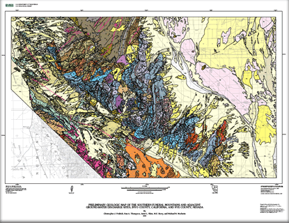
This map covers the southern part of the Funeral Mountains, and adjacent parts of four structural basins—Furnace Creek, Amargosa Valley, Opera House, and central Death Valley. It extends over three full 7.5-minute quadrangles, and parts of eleven others—a total area of about 950 square kilometers. The boundaries of this map were drawn to include all of the known proximal hydrogeologic features that may affect the flow of ground water that discharges from the springs of the Furnace Creek wash area, in the west-central part of the map. These springs provide the major potable water supply for Death Valley National Park. |
Superseded on December 14, 2012 First posted January 7, 2009
|
Fridrich, C.J., Thompson, R.A., Slate, J.L., Berry, M.E., and Machette, M.N., 2008, Preliminary geologic map of the southern Funeral Mountains and adjacent ground-water discharge sites, Inyo County, California, and Nye County, Nevada: U.S. Geological Survey Open-File Report 2008-1366, 1 sheet, scale 1:50,000, pamphlet 16 p.
Introduction
Methods and Approach
A New Regional Cenozoic Tectono-Stratigraphy
Description of Map Units
References Cited

![]() U.S. Department of the Interior |
U.S. Geological Survey
U.S. Department of the Interior |
U.S. Geological Survey
URL: http://pubsdata.usgs.gov/pubs/of/2008/1366/index.html
Page Contact Information: GS Pubs Web Contact
Page Last Modified: Wednesday, 07-Dec-2016 21:19:48 EST
