Open-File Report 2008-1367
Abstract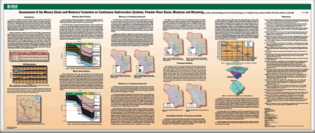
A recent U.S. Geological Survey (USGS) oil and gas assessment of the Powder River Basin , Wyoming and Montana, identified the Upper Cretaceous Mowry Shale and Niobrara Formation as the primary hydrocarbon sources for Cretaceous conventional and unconventional reservoirs. Cumulative Mowry-sourced petroleum production is about 1.2 BBO (billion barrels of oil) and 2.2 TCFG (trillion cubic feet of gas) and cumulative Niobrara-sourced oil production is about 520 MMBO (million barrels of oil) and 0.95 TCFG. Burial history modeling indicated that hydrocarbon generation for both formations started at about 0.60 percent Ro at depths of about 8,000 ft. At maximum depths, Ro for the Mowry is about 1.2 to 1.3 percent and about 0.80 percent for the Niobrara. The Mowry and Niobrara continuous reservoirs were assessed using a cell-based methodology that utilized production data. The size of each cell was based on geologic controls and potential drainage areas in analog fields. Current and historical production data were used to determine the estimated ultimate recovery (EUR) distribution for untested cells. Only production data from unconventional fractured shale reservoirs with vertical wells were used. For the Mowry, the minimum, median, and maximum total recovery volumes per cell for untested cells are (1) 0.002, 0.25, and 0.35 MMBO, respectively; and for the Niobrara (2) 0.002, 0.028, and 0.5 MMBO. Sweet spots were identified by lineaments and faults, which are believed to be areas having the greatest petroleum potential; an upper limit of 8,000 ft depth was defined by overpressuring caused by hydrocarbon generation. Mean estimates of technically recoverable undiscovered continuous resource for the Mowry are 198 MMBO, 198 BCF (billion cubic feet of gas), and 11.9 MMBNGL (million barrels of natural gas liquid), and those for the Niobrara are 227 MMBO, 227 BCFG, and 13.6 MMBNGL. The text in this poster was presented at the American Association of Petroleum Geologists Section Conference in Denver, Colo., on July 9, 2008. |
First posted January 14, 2009 For additional information contact: Part or all of this report is presented in Portable Document Format (PDF); the latest version of Adobe Reader or similar software is required to view it. Download the latest version of Adobe Reader, free of charge. |
Anna, L.O., and Cook, T.A., 2008, Assessment of the Mowry Shale and Niobrara Formation as continuous hydrocarbon systems, Powder River Basin, Montana and Wyoming, American Association of Petroleum Geologists Section Conference, July 9, 2008, Denver, Colo.: U.S. Geological Survey Open-File Report 2008-1367, 1 sheet.

![]() U.S. Department of the Interior |
U.S. Geological Survey
U.S. Department of the Interior |
U.S. Geological Survey
URL: http://pubsdata.usgs.gov/pubs/of/2008/1367/index.html
Page Contact Information: GS Pubs Web Contact
Page Last Modified: Wednesday, 07-Dec-2016 21:38:12 EST
