U.S. Geological Survey Open-File Report 2009-1001
Geological Interpretation of the Sea Floor Offshore of Edgartown, Massachusetts
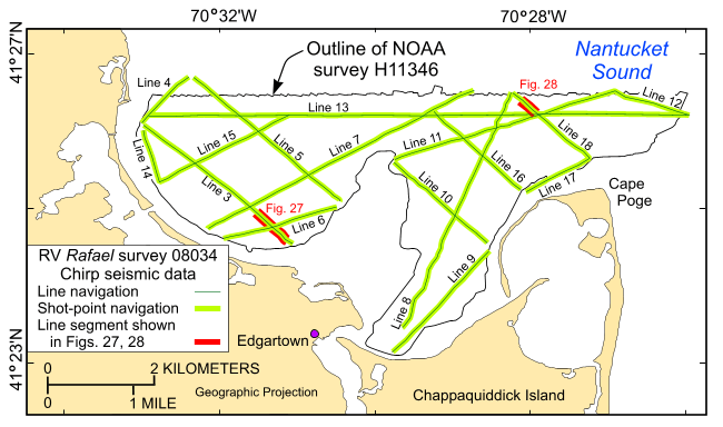 |
Figure 13. The locations of the tracklines (green lines) along which the 16 Chirp high-resolution seismic-reflection profiles were collected during the August 2008 cruise 08034 of the research vessel Rafael. Also shown are the locations of line segments shown in figures 27 and 28 (red segments). Because lines 1 and 2 were test lines along which the survey did not produce useful data, they are not shown on this map. |

![]() U.S. Department of the Interior |
U.S. Geological Survey
U.S. Department of the Interior |
U.S. Geological Survey
URL: https://pubsdata.usgs.gov/pubs/of/2009/1001/html/fig13.html
Page Contact Information: Contact USGS
Page Last Modified: Wednesday, 07-Dec-2016 22:23:01 EST

