U.S. Geological Survey Open-File Report 2009-1001
Geological Interpretation of the Sea Floor Offshore of Edgartown, Massachusetts
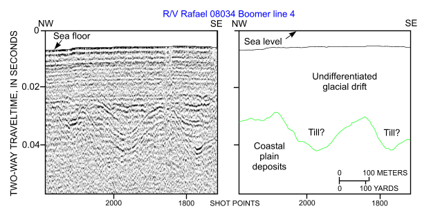 |
Figure 25. Segment of Boomer high-resolution seismic-reflection profile and interpretation from research vessel Rafael cruise 08034 line 4 across the elongate bathymetric high that extends seaward from Middle Flats. Coastal-plain deposits underlie the glacial drift. Location of profile is shown in figure 12. |

![]() U.S. Department of the Interior |
U.S. Geological Survey
U.S. Department of the Interior |
U.S. Geological Survey
URL: https://pubsdata.usgs.gov/pubs/of/2009/1001/html/fig25.html
Page Contact Information: Contact USGS
Page Last Modified: Wednesday, 07-Dec-2016 22:23:08 EST

