Open-File Report 2009-1015
Abstract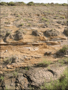
The purpose of this map is to provide an integrated, bi-national geologic map dataset for display and analyses on an Arc Internet Map Service (IMS) dedicated to environmental health studies in the United States–Mexico border region. The IMS web site was designed by the US-Mexico Border Environmental Health Initiative project and collaborators, and the IMS and project web site address is http://borderhealth.cr.usgs.gov/. The objective of the project is to acquire, evaluate, analyze, and provide earth, biologic, and human health resources data within a GIS framework (IMS) to further our understanding of possible linkages between the physical environment and public health issues. The geologic map dataset is just one of many datasets included in the web site; other datasets include biologic, hydrologic, geographic, and human health themes. (Photograph: View of sandstone units in the Laredo Formation south of Laredo, Texas, along U.S. Highway 83.) |
First posted February 5, 2009 Part or all of this report is presented in Portable Document Format (PDF); the latest version of Adobe Reader or similar software is required to view it. Download the latest version of Adobe Reader, free of charge. |
Page, W.R., Berry, M.E., VanSistine, D.P., and Snyders, S.R., 2009, Preliminary geologic map of the Laredo, Crystal City–Eagle Pass, San Antonio, and Del Rio 1° x 2° quadrangles, Texas, and Nuevo Laredo, Ciudad Acuña, Piedras Negras, and Nueva Rosita 1° x 2° quadrangles, Mexico: U.S Geological Survey Open-File Report 2009-1015, 10 p., 2 plates, scale 1:350,000. [Available at URL https://pubs.usgs.gov/of/2009/1015/]
Introduction
Geologic Setting
Methods
Description of Map Units
References Cited

![]() U.S. Department of the Interior |
U.S. Geological Survey
U.S. Department of the Interior |
U.S. Geological Survey
URL: http://pubsdata.usgs.gov/pubs/of/2009/1015/index.html
Page Contact Information: GS Pubs Web Contact
Page Last Modified: Wednesday, 07-Dec-2016 21:50:04 EST
