Geophysical Unit of Menlo Park, Calif.
View looking eastward toward Blue Mountain, north-central Nevada (Photograph by J.T. Watt).
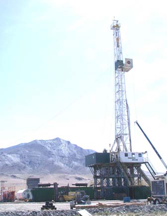
From May to June 2008, the U.S. Geological Survey (USGS) collected and measured physical properties on 36 core samples from drill-hole Deep Blue No. 1 (DB-1) and 46 samples from drill-hole Deep Blue No. 2 (DB-2) along the west side of Blue Mountain about 40 km west of Winnemucca, Nev. These data were collected as part of an effort to determine the geophysical setting of the Blue Mountain geothermal prospect as an aid to understanding the geologic framework of geothermal systems throughout the Great Basin. The physical properties of these rocks and other rock types in the area create a distinguishable pattern of gravity and magnetic anomalies that can be used to infer their subsurface geologic structure.
Drill-holes DB-1 and DB-2 were spudded in alluvium on the western flank of Blue Mountain in 2002 and 2004, respectively, and are about 1 km apart. Drill-hole DB-1 is at a ground elevation of 1,325 m and was drilled to a depth of 672 m and drill-hole DB-2 is at a ground elevation of 1,392 m and was drilled to a depth of 1522 m. Diameter of the core samples is 6.4 cm. These drill holes penetrate Jurassic and Triassic metasedimentary rocks predominantly consisting of argillite, mudstone, and sandstone; Tertiary diorite and gabbro; and younger Tertiary felsic dikes.
Download text of this report as a 22-page PDF file (of2009-1022_text; 6.7 MB).
Download table 2 of this report as a .xls file (of2009-1022_table_2_rock-property_data.xls; 80 kB).
For questions about the content of this report, contact Dave Ponce
Suggested citation and version history
Download a free copy of the latest version of Adobe Reader.
|
Help |
PDF help |
Publications main page |
| Western Open-File Reports for 2009 |
Geologic Division |
| Geophysical Unit of Menlo Park, Calif. (GUMP)
|
Earthquake Hazards Program
|

![]() U.S. Department of the Interior | U.S. Geological Survey
U.S. Department of the Interior | U.S. Geological Survey
URL: https://pubs.usgs.gov/of/2009/1022/
Page Contact Information: Michael Diggles
Page Created: February 19, 2009
Page Last Modified: February 20, 2009
(mfd)