Open-File Report 2009-1189
Abstract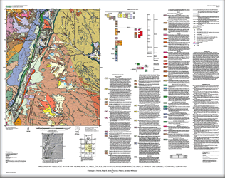
This geologic map covers four 7.5-minute quadrangles-The Wall, NM-CO (New Mexico-Colorado), Vermejo Park, NM-CO, Ash Mountain, NM, and Van Bremmer Park, NM. The study area straddles the boundary between the eastern flank of the Sangre de Cristo Mountains and the western margin of the Raton Basin, with about two-thirds of the map area in the basin. The Raton Basin is a foreland basin that formed immediately eastward of the Sangre de Cristo Mountains during their initial uplift, in the Late Cretaceous through early Eocene Laramide orogeny. Subsequently, these mountains have been extensively modified during formation of the Rio Grande rift, from late Oligocene to present. The map area is within that part of the Sangre de Cristo Mountains that is called the Culebra Range. Additionally, the map covers small parts of the Devil's Park graben and the Valle Vidal half-graben, in the northwestern and southwestern parts of the map area, respectively. These two grabens are small intermontaine basins, that are satellitic to the main local basin of the Rio Grande rift, the San Luis Basin, that are an outlying, early- formed part of the rift, and that separate the Culebra Range from the Taos Range, to the southwest. |
First posted September 16, 2009 For additional information contact: Part or all of this report is presented in Portable Document Format (PDF); the latest version of Adobe Reader or similar software is required to view it. Download the latest version of Adobe Reader, free of charge. |
Fridrich, C.J., Shroba, R.R., Pillmore, C.L., and Hudson, A.M., 2009, Preliminary geologic map of the Vermejo Peak area, Colfax and Taos Counties, New Mexico, and Las Animas and Costilla Counties, Colorado: U.S. Geological Survey Open-File Report 2009–1189, 1 sheet, scale 1:50,000.

![]() U.S. Department of the Interior |
U.S. Geological Survey
U.S. Department of the Interior |
U.S. Geological Survey
URL: http://pubsdata.usgs.gov/pubs/of/2009/1189/index.html
Page Contact Information: GS Pubs Web Contact
Page Last Modified: Wednesday, 07-Dec-2016 22:00:47 EST
