U.S. Geological Survey Open-File Report 2009-1191
ABSTRACT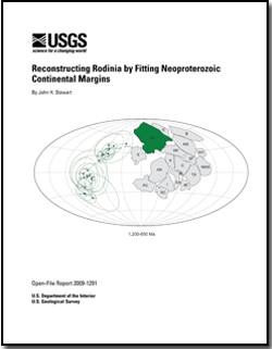
Reconstructions of Phanerozoic tectonic plates can be closely constrained by lithologic correlations across conjugate margins by paleontologic information, by correlation of orogenic belts, by paleomagnetic location of continents, and by ocean floor magmatic stripes. In contrast, Proterozoic reconstructions are hindered by the lack of some of these tools or the lack of their precision. To overcome some of these difficulties, this report focuses on a different method of reconstruction, namely the use of the shape of continents to assemble the supercontinent of Rodinia, much like a jigsaw puzzle. Compared to the vast amount of information available for Phanerozoic systems, such a limited approach for Proterozoic rocks, may seem suspect. However, using the assembly of the southern continents (South America, Africa, India, Arabia, Antarctica, and Australia) as an example, a very tight fit of the continents is apparent and illustrates the power of the jigsaw puzzle method. This report focuses on Neoproterozoic rocks, which are shown on two new detailed geologic maps that constitute the backbone of the study. The report also describes the Neoproterozoic, but younger or older rocks are not discussed or not discussed in detail. The Neoproterozoic continents and continental margins are identified based on the distribution of continental-margin sedimentary and magmatic rocks that define the break-up margins of Rodinia. These Neoproterozoic continental exposures, as well as critical Neo- and Meso-Neoproterozoic tectonic features shown on the two new map compilations, are used to reconstruct the Mesoproterozoic supercontinent of Rodinia. This approach differs from the common approach of using fold belts to define structural features deemed important in the Rodinian reconstruction. Fold belts are difficult to date, and many are significantly younger than the time frame considered here (1,200 to 850 Ma). Identifying Neoproterozoic continental margins, which are primarily extensional in origin, supports recognition of the Neoproterozoic fragmentation pattern of Rodinia and outlines the major continental masses that, prior to the breakup, formed the supercontinent. Using this pattern, Rodinia can be assembled by fitting the pieces together. Evidence for Neoproterozoic margins is fragmentary. The most apparent margins are marked by miogeoclinal deposits (passive-margin deposits). The margins can also be outlined by the distribution of continental-margin magmatic-arc rocks, by juvenile ocean-floor rocks, or by the presence of continent-ward extending aulacogens. Most of the continental margins described here are Neoproterozoic, and some had an older history suggesting that they were major, long-lived lithospheric flaws. In particular, the western margin of North America appears to have existed for at least 1,470 Ma and to have been reactivated many times in the Neoproterozoic and Phanerozoic. The inheritance of trends from the Mesoproterozoic by the Neoproterozoic is particularly evident along the eastern United States, where a similarity of Mesoproterozoic (Grenville) and Neoproterozoic trends, as well as Paleozoic or Mesozoic trends, is evident. The model of Rodinia presented here is based on both geologic and paleomagnetic information. Geologic evidence is based on the distribution and shape of Neoproterozoic continents and on assembling these continents so as to match the shape, history, and scale of adjoining margins. The proposed model places the Laurasian continents—Baltica, Greenland, and Laurentia—west of the South American continents (Amazonia, Rio de La Plata, and Saõ Francisco). This assembly is indicated by conjugate pairs of Grenville-age rocks on the east side of Laurentia and on the west side of South America. In the model, predominantly late Neoproterozoic magmatic-arc rocks follow the trend of the Grenville rocks. The boundary between South America and Africa is interpreted as the site of a Wilson cycle, in which Rodinia fragmented in the Neoproterozoic, forming an ocean that then closed in the late Neoproterozoic. Although many have proposed a similar model for East Gondwana, the interpretation presented here suggests that the East Gondwana continents were previously assembled at least as early as the Mesoproterozoic. The validity of the model is tested by drawing upon paleomagnetic data. Paleomagnetic poles from the continents of Amazonia, Baltica, Congo, Kalahari, Siberia, and possibly Australia (the main components of the model) are compatible with the reconstruction. |
For additional information: This report is presented in Portable Document Format (PDF); the latest version of Adobe Reader or similar software is required to view it. Download the latest version of Adobe Reader, free of charge. |
Stewart, J.H., 2009, Reconstructing Rodinia by fitting Neoproterozoic continental margins: U.S. Geological Survey Open-File Report 2009-1191, 94 p., 3 plates.
Abstract
Introduction
Recognition and Classification of Neoproterozoic Continental Margins
Middle and Upper Neoproterozoic Continents and Continental Margins
Methods of Meso-Neoproterozoic Reconstructions
Neoproterozoic Reconstructions
Paleomagnetic Studies
References
three plates

![]() U.S. Department of the Interior |
U.S. Geological Survey
U.S. Department of the Interior |
U.S. Geological Survey
URL: http://
pubsdata.usgs.gov
/pubs/of/2009/1191/index.html
Page Contact Information: USGS Publications Team
Page Last Modified: Wednesday, 07-Dec-2016 22:05:19 EST
