Open-File Report 2009–1246
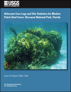
ABSTRACTThe bedrock in Biscayne National Park (BNP), a 1,730-square kilometer (km2) region off southeast Florida, consists of Pleistocene (1.8 million years ago (Ma) to 10,000 years ago (ka)) and Holocene (10 ka to present) carbonate rocks (Enos and Perkins, 1977; Halley and others, 1997; Multer and others, 2002). Most of the surficial limestone in BNP, including the islands of the Florida Keys, was formed at ~125 ka during the highstand of marine oxygen-isotope substage 5e, when sea level was approximately 6 meters (m) higher than today (Chappell and Shackleton, 1986; Multer and others, 2002; Lidz and others, 2003; Siddall and others, 2003; Balsillie and Donoghue, 2004). During the substage-5e regression, the entire Florida Platform became exposed. Subaerial exposure lasted for approximately 115,000 years (kyr), which resulted in erosion and enhancement of karst-like features (Lidz and others, 2006). As the Holocene transgression began to flood the Florida shelf ~7 to 6 ka, the bedrock depression under Biscayne Bay began to flood, and Holocene coral and reef debris laid the foundation for the present reef system (Enos and Perkins, 1977; Lighty and others, 1982; Toscano and Macintyre, 2003; Lidz and others, 2006). More than 3,000 patch reefs exist within the BNP boundary. Most contain hermatypic corals of various species such as those belonging to Montastrea, Diploria, Siderastrea, Porites, Acropora, and Agaricia. Patch reefs within BNP have two morphologies: pinnacle and flat top. Experimental Advanced Airborne Research Lidar (EAARL) data collected along the offshore BNP coral reef tract show that these two morphologies are clearly defined both in the high-resolution bathymetry maps produced by the Lidar data and by statistical analyses of the Lidar dataset (Brock and others, 2008). Brock and others (2008) also show that the pinnacle patch reefs are deeper than the more shallow, broad, and flat patch reefs. The control for these two patch-reef morphologies is unclear; however, their shapes may be due to a slightly lowered sea level or a stillstand in the middle-Holocene around 4 ka that caused erosion of the shallower reefs and allowed the deeper reefs to remain unaffected. Lidz and others (2006) have suggested a stillstand around 4 ka that carved a 2.5-kilometer (km)-wide nearshore rock ledge into the seaward side of every island in the Florida Keys. The objectives of this study were to sample living corals to understand the more recent (<200 years) changes in climate and environmental conditions of the area and to investigate the Holocene (in this case, <8,000 years in the Florida Keys) depositional history at progressively deeper patch-reef sites. This report provides statistics for the cores and core sites and a basic lithologic description of these Holocene cores. |
First posted December 8, 2009 For additional information contact: Part or all of this report is presented in Portable Document Format (PDF); the latest version of Adobe Reader or similar software is required to view it. Download the latest version of Adobe Reader, free of charge. |
Reich, C.D., Hickey, T.D., DeLong, K.L., Poore, R.Z., and Brock, J.C., 2009, Holocene core logs and site statistics for modern patch-reef cores—Biscayne National Park, Florida: U.S. Geological Survey Open-File Report 2009–1246, 26 p.
Introduction
Methods
Coring
Core Location Elevation Survey
Results and Summary
Coral Cores
Wireline Cores
X-Ray Diffraction and Carbon-14 Analyses
Acknowledgments
References Cited
Appendix A. Photographs of coral heads after drilling, Biscayne National Park
Appendix B. Core logs and photographs of the cores at each location, Biscayne National Park

![]() U.S. Department of the Interior |
U.S. Geological Survey
U.S. Department of the Interior |
U.S. Geological Survey
URL: http://pubsdata.usgs.gov/pubs/of/2009/1246/index.html
Page Contact Information: USGS Publications Team
Page Last Modified: Wednesday, 07-Dec-2016 22:05:51 EST
