Open-File Report 2010-1334
1U.S. Geological Survey, P.O. Box 25046 MS 980, Denver , Colo.
2Kent State University, Kent, Ohio
3Utah Geological Survey, Salt Lake City, Utah
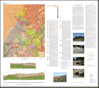
The Cottonwood Mountain quadrangle is a structurally complex terrane composed of several features, from oldest to youngest: (1) low-angle faults, (2) megabreccia deposits, and (3) horsts and grabens. Low-angle faults are of two ages: an older age group referred to as the Red Hills low-angle shear zone, and younger faults related to later uplift mapped in the Parowan quadrangle. The Red Hills shear zone in the Red Hills, approximately 8 km west of quadrangle, is interpreted to be a low-angle Miocene structure that extends into the Markagunt Plateau and is of regional extent. This shear zone has detached part of the Brian Head Formation and overlying rocks from underlying rocks, possibly along the contact between the Brian Head Formation and the base of Tertiary volcanic rocks, or in some areas, within the upper part of the Brian Head Formation. On the geologic map, the shear zone is approximately placed at the contact between the Brian Head Formation and the base of Tertiary volcanic rocks even though it may occur below that contact. The shear zone is variously characterized by pulverized rock and discordance in bed attitudes and by thinning or omission of rock units overlying the shear zone. The structurally incompetent rocks of the Brian Head Formation allowed slip to be localized within this unit. The shear zone and overlying detached plate are offset by later high-angle faults and are preserved in the grabens and eroded from horsts. The age of the Red Hills low-angle fault is older than about 20 Ma since the dated northwest trending mafic dikes intrude both the lower and upper plate of the Red Hills shear zone. Other low-angle faults are found in the adjacent Parowan quadrangle to the southwest of map area but have not been found in the map area. These faults are younger than the Red Hills shear zone, possibly related to later uplift of the Markagunt Plateau or adjacent Red Hills. The faults merge locally with the Red Hills shear zone, and it is impossible to differentiate the two in some areas. Locally, the faults become steeper along part of their segment suggesting rotation of blocks containing these faults. The purpose of this report is to map the geology of the quadrangle at 1:24,000 to be used to compile the Panquitch 1:100,000 scale sheet. |
First posted May 3, 2011 For additional information contact: This report is presented in Portable Document Format (PDF); the latest version of Adobe Reader or similar software is required to view it. Download the latest version of Adobe Reader, free of charge. |
Maldonado, Florian, Anderson, J.J., and Biek, R.F., 2011, Preliminary geologic map of the Cottonwood Mountain quadrangle, Iron County, Utah: U.S. Geological Survey Open-File Report 2010–1334, 1 sheet, scale 1:24,000.

![]() U.S. Department of the Interior |
U.S. Geological Survey
U.S. Department of the Interior |
U.S. Geological Survey
URL: http://pubsdata.usgs.gov/pubs/of/2010/1334/index.html
Page Contact Information: GS Pubs Web Contact
Page Last Modified: Wednesday, 07-Dec-2016 23:24:40 EST
