U.S. Geological Survey Open-File Report 2011–1003
Combined Multibeam and LIDAR Bathymetry Data from Eastern Long Island Sound and Westernmost Block Island Sound – A Regional Perspective
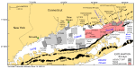
The U.S. Geological Survey (USGS), in cooperation with National Oceanic and Atmospheric Administration (NOAA) and the Connecticut Department of Environmental Protection (CT DEP), is producing detailed maps of the sea floor in Long Island Sound (fig. 1). The current phase of this cooperative research program is directed toward studies of sea-floor topography and its effect on the distributions of sedimentary environments and benthic communities. As part of this phase, individual hydrographic datasets are converted into Geographic Information System (GIS)-compatible formats, verified with bottom photography and sampling, and geologically interpreted. Each of these GIS datasets, covering areas ranging from 12 to 293 square kilometers (km²), individually provides important benthic environmental information, but many applications require a geographically broader perspective. The purpose of this report is to release raster grids and sun-illuminated GeoTIFFs of the integrated digital terrain models (DTMs) from multibeam echosounder data collected during NOAA surveys H11250, H11251, H11252, H11361, H11441, H11442, H11445, H11446, H11997, H11999, H12012, and H12013, and from hydrographic LIDAR (Light Detection and Ranging) data collected during NOAA surveys H11224 and H11225. Together these combined bathymetric surveys form a continuous 707.5-km² area that extends across eastern Long Island Sound and into westernmost Block Island Sound, providing a more regional perspective than previously available (fig. 1). Because anthropogenic wastes, toxic chemicals, and changes in land-use patterns resulting from residential, commercial, and recreational development have stressed the environment of the sound and caused degradation and potential loss of benthic habitats (Koppelman and others, 1976; Long Island Sound Study, 1994), detailed maps and interpretations of the sea floor are needed to evaluate the extent of adverse impacts and to manage resources wisely in the future. To that end, the detailed maps and datasets produced as part of this cooperative program serve many purposes, including (1) defining the topographic variability of the sea floor, which is one of the primary controls of benthic habitat diversity; (2) improving our understanding of the oceanographic processes that control the distribution and transport of bottom sediments and the distribution of benthic habitats and associated infaunal community structures; and (3) providing a detailed framework for future research, monitoring, and management activities. These datasets also serve as base maps for subsequent sedimentological, geochemical, and biological observations, because precise information on topography and environmental setting is important for the selection of sampling sites and for accurate extrapolation and interpretation of point measurements. |